

Volcano Tours in Guatemala: the Pacaya and the Acatenango
Thirty-seven volcanoes, three of them erupting, and 19 experiences that all leave from the same small colonial town.
Guatemala has thirty-seven volcanoes and sells two of them. That is not a complaint about the country, it is a description of where the roads and the licensed guides are. The Fuego erupts several times an hour and cannot be climbed. The Acatenango, joined to it, can be, and people sleep on it to watch. The Pacaya is close enough to the international airport to be done between two flights. Everything else on the list, including the highest peak in Central America, carries almost no commercial traffic at all. The nineteen experiences here all begin within an hour of one small colonial town, and working out why is most of the planning.
The two products are not variations on a theme. One is a morning: a bus, a walk up a cinder cone, hot ground under your boots, back in town for lunch. The other is two days, a night near 3,750 metres in temperatures around freezing, and a 3,976 metre summit at four in the morning. They are sold in the same shops on the same street and the gap between them is the largest of any volcano destination we cover. This page is about the country and the choice between the two. The detail of each one lives in its own page below.
Choose a destination in Guatemala

Volcano Travel Experiences in Guatemala
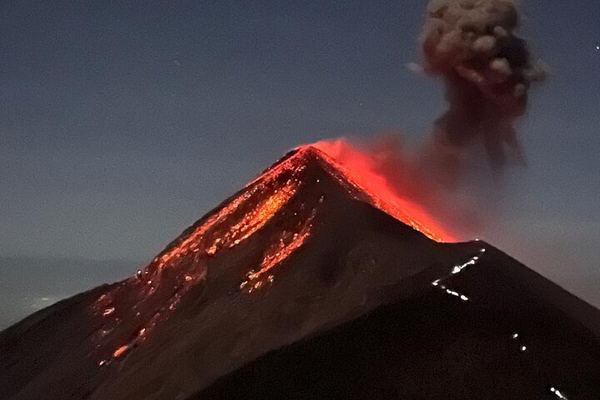
Acatenango by the Private Miratenango Route: 80 Minutes Shorter, Camp Ixcanul
The private path from Miratenango saves an hour and twenty minutes on the climb, and camp Ixcanul faces Fuego, with the bonfire at 6:30 and dinner at 7:30.
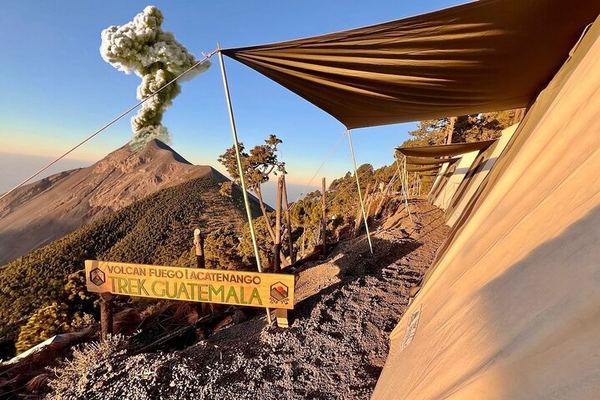
Acatenango Glamping: Safari Tents at 3,750 m, Four Ecosystems on the Way Up
Cots and mattresses in safari tents at camp, four ecosystems crossed on the way up, and a summit hour with the highlands running as far as Mexico.
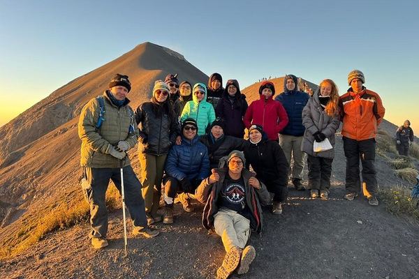
Acatenango Overnight with Brothers Expeditions: Camping on the Slope
The camp is pitched on the slope for a night under the stars, and the booking is final: this operator does not refund cancellations at any notice.
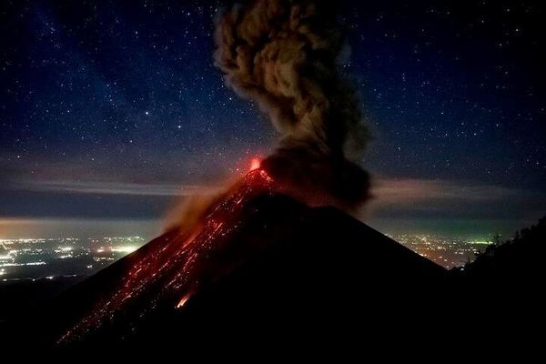
Acatenango Overnight with OX: Pre-Trip Briefing the Day Before, Summit at Dawn
The briefing is at 5PM the day before, breakfast is included at the start, and camp is reached by 2PM with the active Fuego cone in front of it.
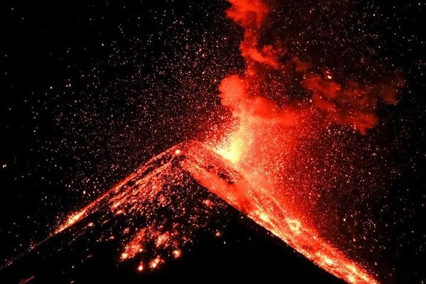
Acatenango with CA Travelers: Cabins for Four, -6°C Bags, Guides from San José Calderas
Cabins sleep four with -6 °C bags and a 12 cm mattress, and the guides are a cooperative from San José Calderas. Sales are final, with no refunds.
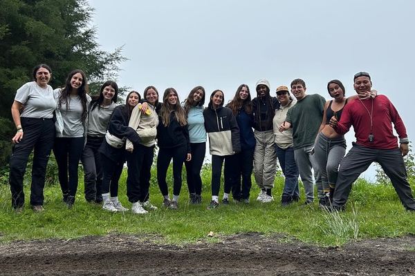
Acatenango with Pachamama: the Short Route, Glass-Fronted Cabins, Fuego at 200 Metres
The shorter path skips the hardest section, the cabins have glass doors facing the volcano, and the summit only happens if half the group wants it.
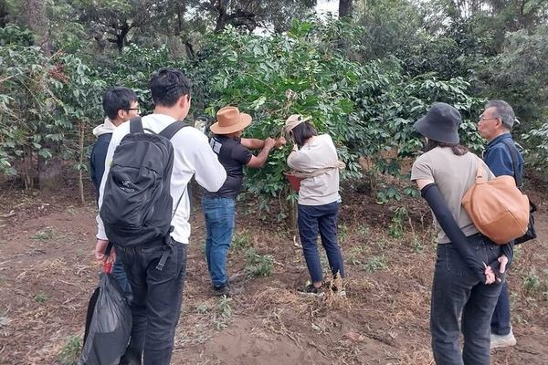
Coffee with the Grower Below the Agua Volcano, in an Open Car
The visit is with the farmer rather than at a visitor centre, on the ground below Agua, and the drive out of Antigua is done in an open car with a tasting.
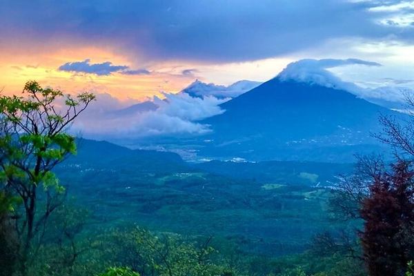
Pacaya at Sunset on Horseback: a Lava Chef, Dinner with Wine and S'mores
Three guides, one of them a cowboy with the horse, and a chef cooking at the base of the cone: dinner with wine at sunset and s'mores toasted on the lava.
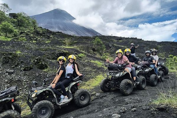
Pacaya by ATV: Private Plantation Lava Fields, Not the National Park
The quads ride the trails and a private plantation around the volcano rather than entering the national park, with snacks and entrance fees included.
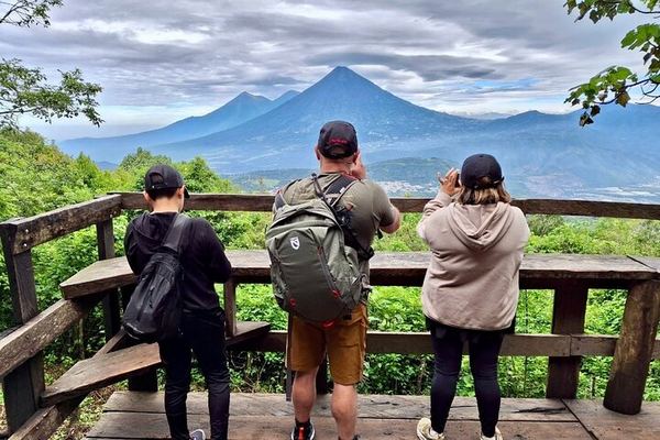
Pacaya by Private Van: 7am to 2:30pm, with a Cold Drink at the Bottom
The van is yours alone, with a cooler on board, and the timings run from a 7:00 pick-up to a 14:30 return, with a drink included at the bottom.
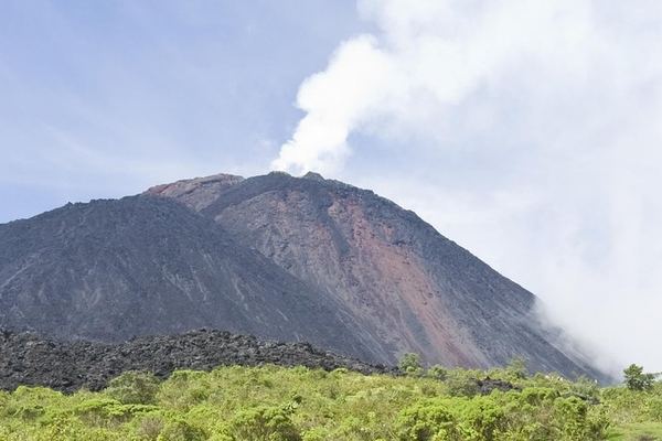
Pacaya Day Trip from Guatemala City, Crater Viewed Not Entered
The main crater is looked at from a plateau rather than entered, and the Calderas lagoon viewpoint has Agua, Fuego and Acatenango all in the same view.
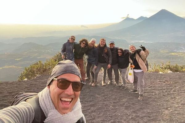
Pacaya from Antigua at 6am or 2pm: 1.5 Hours Up, Marshmallows on the Lava
Pick-up runs at 6:00 or 14:00 and is attempted once only, the park fee is paid separately, and the climb takes about an hour and a half to the petrified lava.
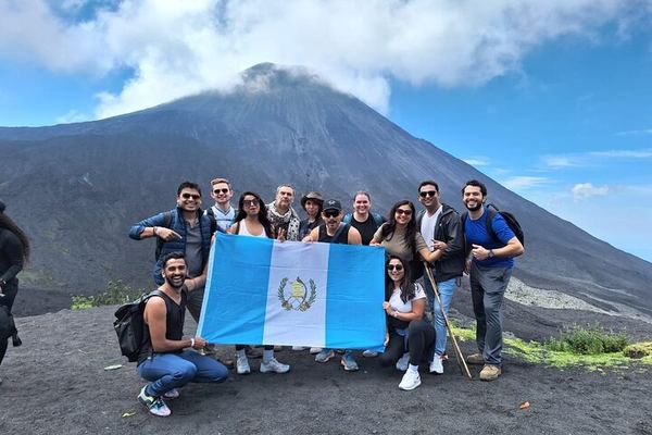
Pacaya from Antigua: the Plateau, the Steam Vents and Three Volcanoes in View
The crater is seen from the plateau rather than the rim, but the heat is close enough to roast marshmallows, with Agua, Fuego and Acatenango in view.
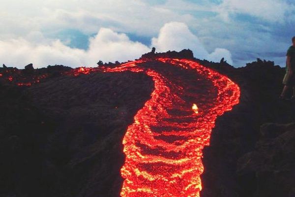
Pacaya from Guatemala City, Through Forest, Farmland and Lava
The trail runs 3.7 km through forest, farmland and lava, and the fumaroles at the top may be throwing ash or rock while you watch them from a distance.
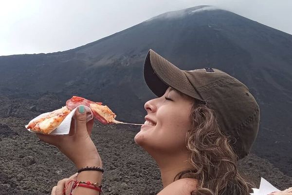
Pacaya Hike from Guatemala City with Pizza Baked Under Volcanic Rock
The chef bakes the pizza under volcanic rock when the mountain is hot enough for it, and over charcoal when it is not. The climb up takes 35 to 90 minutes.
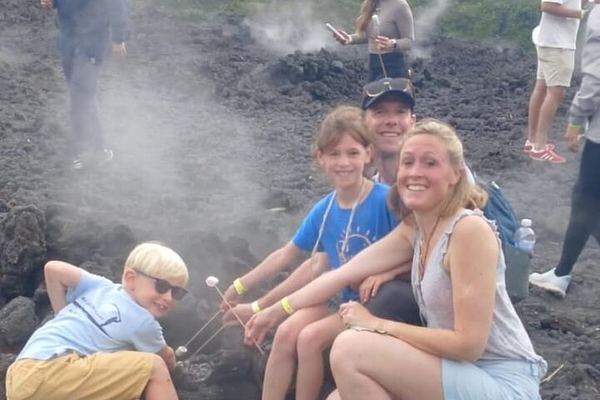
Pacaya, One of National Geographic's Ten Most Adventurous, from Antigua
National Geographic put this walk among the ten most adventurous in the world, and the view from the top reaches the Pacific coast and the capital's valley.
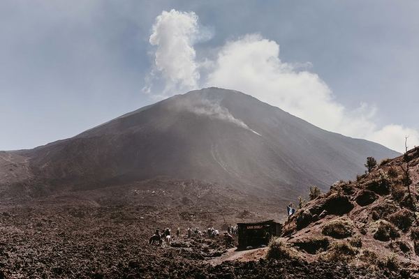
Pacaya Shared Hike from Guatemala City, Entrance Fee Apart
An hour and a half to San Vicente Pacaya, the same again to the top, an hour to come back down. The basic option leaves the volcano entrance fee to you.
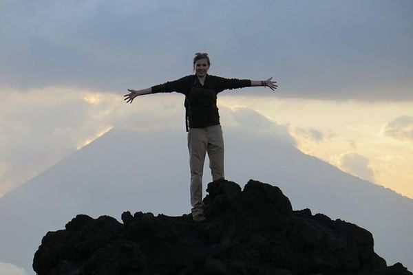
Pacaya to la Meseta with Old Town Outfitters: 8am to 4pm, Picnic on the Lava
The meet is at the outfitters' shop at 08:00, the climb takes ninety minutes to the shelf below the cone, and the picnic is eaten out on the lava field.
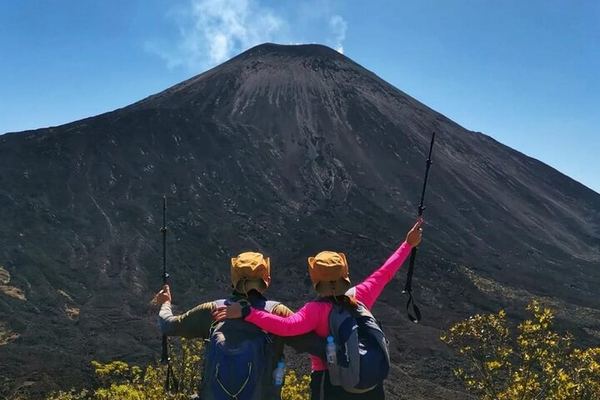
Pacaya via the Calderas Lagoon: 2.5 Hours Up, No Crater Access
The crater is off limits for safety, so the walk ends on the plateau, where the running lava and the steam vents are, past the lagoon of Calderas.
Ratings collected by Viator and Tripadvisor
Thirty-seven volcanoes, three of them doing anything
The catalogue of Guatemalan volcanoes runs to thirty-seven cones, and the number is worth almost nothing on its own. Most last erupted before anyone was writing it down. Three are active in the ordinary sense of the word: the Fuego, which explodes at low level several times an hour; the Santiaguito, a lava dome complex that has been growing since 1922; and the Pacaya, which began erupting vigorously in 1961 and has not really stopped. Two more matter to a visitor without being active at all. The Agua, at 3,760 metres, is the cone you see from every rooftop in Antigua and has done nothing since the Pleistocene. The Acatenango last erupted in December 1972 and is the reason anyone can get near the Fuego safely.
| Volcano | Height | Status | Usual base | Sold here |
|---|---|---|---|---|
| Fuego | 3,763 m | Erupting; 4 to 12 explosions an hour through 2026 | Antigua | No. Access is prohibited |
| Acatenango | 3,976 m | Last erupted December 1972 | Antigua | Yes, 6 overnight treks |
| Pacaya | 2,552 m | Erupting since 1961 | Antigua or Guatemala City | Yes, 12 day trips |
| Agua | 3,760 m | Extinct; last active in the Pleistocene | Antigua | No, but the coffee farms on it are |
| Santa Maria / Santiaguito | 3,772 m | Dome complex erupting since 1922 | Quetzaltenango | No |
| Atitlan | 3,535 m | Last erupted 1853 | Panajachel | No |
| Toliman | 3,158 m | No eruption in recorded history | San Pedro La Laguna | No |
| San Pedro | 3,020 m | Stopped erupting around 40,000 years ago | San Pedro La Laguna | No |
| Tajumulco | 4,220 m | Last erupted 1863; highest peak in Central America | Quetzaltenango | No |

Everything starts in Antigua, not in the capital
The international airport is in Guatemala City. Almost nothing volcanic is. Of the nineteen listings here, fifteen pick up in Antigua and the four that pick up in the capital are all going to the Pacaya, an hour further away than they need to be. The transfer from the airport to Antigua takes forty-five minutes to an hour, and it is the single most useful thing to book before you arrive.
The concentration is not an accident of taste. The guides live there, the two mountains that can be walked are within an hour of the town, and Antigua is the only place in the country with enough licensed operators to make an eight in the morning departure reliable seven days a week. There is also a founding reason. Antigua exists because of a volcano. On 10 September 1541 a mudflow off the Agua destroyed Santiago de los Caballeros, the colonial capital, and the survivors moved the city a few kilometres north to the valley where you now book your tour.
The Fuego and the Acatenango are one mountain
This is the fact that reorganises the whole trip once you have it. The Fuego and the Acatenango are not neighbours, they are two vents on a single massif called La Horqueta, separated by a scarp named La Meseta which is what remains of an older edifice that collapsed around 8,500 years ago. The Fuego sits roughly 16 kilometres west of Antigua and explodes at low level several times an hour. That is the ordinary state. The extraordinary state killed at least 190 people on 3 June 2018, with 256 more never found, and it remains the deadliest eruption in the country since 1902.
So the arrangement that every operator sells is the only one permitted: you climb the mountain next door and watch across the saddle. Access to the Fuego is prohibited, and this is a documented rule rather than an operator's preference. On 4 August 2026 the Guatemalan tourism institute, INGUAT, stated that access to the Acatenango was restricted and that the ban on entering the Fuego was being maintained. On 10 August it confirmed that entry to the Fuego through the park remains prohibited and that only observation points are authorised. If a listing offers you the summit of the Fuego, it is offering something that is not allowed.
El acceso al Volcan de Fuego por medio del parque permanece prohibido. INGUAT, 10 August 2026. Only designated observation points are open, and they are reached from the Acatenango side.

What happened here in August 2026
Anyone booking this trip now should know what the mountain did a week before this page was written, because it is a fair picture of the range the country lives with. Between 3 and 5 August 2026 the Fuego ran a paroxysmal episode: ash columns 5,000 to 7,000 metres above sea level, pyroclastic density currents down five separate ravines and lahars reaching seven kilometres. CONRED held a national orange alert with red in three departments. Around 29,000 people were affected by ashfall and 1,699 were evacuated into five shelters. INSIVUMEH declared the paroxysm over on 5 August.
Two days later the Acatenango reopened, announced by the Municipalidad de Acatenango with technical sign-off from INGUAT and INSIVUMEH. That is the part worth carrying with you: the decision to open or close the trekking mountain is taken by the municipality on technical advice, not by the agency you booked through, and it can change inside a week in either direction. Guatemala's emergency number for visitors is 1500.
The lake, the west, and the volcanoes nobody sells
Two other volcanic regions get written about constantly and booked almost never, and it is worth being clear about which is which before you build an itinerary around a photograph.
Lake Atitlan sits at 1,562 metres in a caldera 340 metres deep at its deepest point, with three cones on its southern shore. Only one of them is genuinely active: the Atitlan, 3,535 metres, last erupted in 1853. The Toliman at 3,158 metres has produced nothing in recorded history and is probably still alive. The San Pedro, 3,020 metres, stopped around forty thousand years ago and is the one people actually walk up, from the town of San Pedro La Laguna, because it is the shortest. What you get at the top is a view of the lake. It is a fine day out and it is not a volcano experience, and you should know which you are buying.
The west is the opposite case. The Santa Maria erupted in October 1902 with a force that put roughly eight cubic kilometres of magma into the air, held 160 kilometres of country in total darkness for fifty-three hours, killed around six thousand people and dropped ash on San Francisco, four thousand kilometres away. Twenty years later the Santiaguito dome complex began to grow in the scar, and it is still erupting today from the vent called El Caliente. You watch it from ridges above Quetzaltenango, and after the Fuego it is the best active-volcano viewing in the country. We sell none of it, because the operators there are a handful of local outfits with no international distribution, and listing something we cannot check is worse than admitting the gap.
What a volcano day costs here
Guatemala is the cheapest volcano destination we cover, and the spread inside it is still nearly seventeen-fold. The floor is a shared minibus and a guide: twenty-one euros gets you to the Pacaya and back. The ceiling is a safari tent with a cot, facing the Fuego. What moves the price is transport, group size and whether food and the park fee are inside the number, in that order, and the park fee is the one that catches people out because several operators take it in cash on the mountain.
| Type of day | Leaves from | Price | How long |
|---|---|---|---|
| Pacaya hike, shared group | Antigua | 21 to 26 EUR | 5 hours |
| Pacaya with private transport, lunch or both | Antigua | 84 to 122 EUR | 5 to 8 hours |
| Pacaya as a day trip from the capital | Guatemala City | 64 to 172 EUR | 6 to 8 hours |
| Pacaya by quad bike or on horseback | Antigua | 110 to 295 EUR | 6 hours |
| Acatenango overnight, shared camp | Antigua | 78 to 115 EUR | 2 days, 1 night |
| Acatenango overnight, private cabins or glamping | Antigua | 334 EUR | 2 days, 1 night |
| Coffee farm on the slopes of the Agua | Antigua | 45 EUR | half day |
When to come, and what the rain takes away
| Month | 1 | 2 | 3 | 4 | 5 | 6 | 7 | 8 | 9 | 10 | 11 | 12 |
|---|---|---|---|---|---|---|---|---|---|---|---|---|
| PacayaRuns all year; in the wet months take the morning departure, before the afternoon build-up closes the view | 1 | 2 | 3 | 4 | 5 | 6 | 7 | 8 | 9 | 10 | 11 | 12 |
| AcatenangoThe Fuego is only worth a night when the sky is clear; from May to October the camp spends most of it inside cloud | 1 | 2 | 3 | 4 | 5 | 6 | 7 | 8 | 9 | 10 | 11 | 12 |
Months are shown as numbers. Based on the Guatemalan dry season, roughly November to April, and on operator departure patterns. Checked August 2026.
The capital of Guatemala has moved more than once, and a volcano moved it the first time. A mudflow off the Agua destroyed Santiago de los Caballeros on 10 September 1541; earthquakes emptied its replacement in 1773. The town you book your tour in is the one they walked away from.
Fitting both of them into a week
Two volcano days is the right number for a first trip, and the order is not arbitrary. Antigua sits at 1,545 metres. The Pacaya walk tops out at a viewpoint near 2,297. The Acatenango camp is between 3,750 and 3,756 depending on the operator and the summit is 3,976. Doing the Pacaya first is a real, if modest, piece of acclimatisation, and it also tells you honestly whether you enjoy walking uphill on loose volcanic gravel before you commit two days and a night to doing it for six hours straight.
Leave a rest day between them. The Acatenango descent gets people back to Antigua around one in the afternoon on the second day, tired in a way that makes an early bus the next morning a bad idea. And book the Acatenango for a clear stretch if you have any flexibility at all: the whole product is a view of another mountain, and cloud does not refund.
Questions people actually ask
How many volcanoes does Guatemala have, and how many are active?
Thirty-seven are catalogued, of which three are erupting in any meaningful present tense: the Fuego, the Santiaguito and the Pacaya. A fourth, the Atitlan, last erupted in 1853 and is classed as active. The rest range from long dormant to extinct, including the Agua that dominates the skyline above Antigua, which has done nothing since the Pleistocene.
Can you climb the Volcan de Fuego?
No, and it is a documented prohibition rather than a convention. INGUAT stated on 4 August 2026 that the ban on entering the Fuego was being maintained, and confirmed on 10 August that access through the park remains prohibited with only observation points authorised. The volcano explodes at low level several times an hour and its 2018 eruption killed at least 190 people. What is sold instead is the overnight trek on the Acatenango, from which you watch across the saddle, plus an optional walk to an authorised viewpoint on the connecting ridge.
Pacaya or Acatenango, if I can only do one?
Pacaya if you want a volcano in a morning and you are not confident about six hours of climbing. Acatenango if the point of the trip is to see an eruption. They are not close in difficulty: the Pacaya is a couple of hours on foot to a viewpoint near 2,297 metres, the Acatenango is a full day of ascent to a camp near 3,750 and a 4 a.m. summit push in the cold. The Pacaya is also the honest choice for anyone travelling with children or with a cardiac history.
Do tours leave from Guatemala City or from Antigua?
Fifteen of the nineteen listings here start in Antigua, and every Acatenango trek does. Four Pacaya day trips leave from Guatemala City, which adds around an hour each way for no gain unless that is where you are sleeping. The practical arrangement is to transfer from the airport to Antigua on arrival, forty-five minutes to an hour, and base yourself there.
How much does a volcano tour in Guatemala cost?
From 21 EUR for a shared Pacaya hike to 334 EUR for the most comfortable Acatenango camp, with the middle of the market at roughly 100 EUR for either. Check whether the park entrance is included before you compare two prices: both mountains charge 100 quetzales for foreign visitors, and several operators exclude it and take it in cash at the gate.
When is the best time of year?
The dry season, roughly November to April, and within it December to March. The reason is not comfort, it is visibility: the Acatenango sells a view of the Fuego at night, and in the wet months the camp sits inside cloud for most of it. The Pacaya works year round if you take a morning departure, because the build-up that closes the view usually arrives in the afternoon.
Is it safe to visit an active volcano in Guatemala?
On the two mountains that are sold, under a guide, yes, and the boundaries are real ones: the Fuego is prohibited, the Pacaya route is inside a national park with a gate and a fee, and INSIVUMEH publishes daily bulletins that guides follow. August 2026 showed how the system works in practice: the Fuego ran a paroxysm from 3 to 5 August, the Acatenango closed, and it reopened on 7 August by decision of the municipality with technical sign-off. The risks that actually reach visitors are more ordinary. Cold near 3,750 metres overnight, altitude on people who arrived from sea level two days earlier, and loose ash underfoot on both descents.
Data verified on. Prices and counts read from the 19 Guatemalan products on this site. Access rules from INGUAT, activity from INSIVUMEH bulletins, heights from the published volcanological record.