
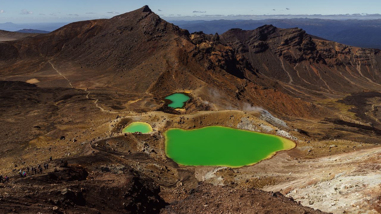
Tongariro Alpine Crossing: Shuttles, Guides and the Route
19.4 km one way, high point 1,886 m at the Red Crater. DOC says there is no parking at the start in summer, which is what makes the shuttle compulsory in practice.
The Tongariro Alpine Crossing goes one way. It starts at Mangatepopo at 1,120 metres, climbs to the Red Crater at 1,886, and comes down the far side to Ketetahi at 760, and the two ends are about 25 kilometres apart by road with a mountain in between. That single fact governs the whole day: the car you arrived in cannot meet you, the Department of Conservation no longer lets Crossing walkers park at the start in summer at all, and the transport is therefore not a convenience but the thing that makes the walk possible.
This page is the crossing as an undertaking: how the day breaks down, why the transport works the way it does, what the weather rule actually says, and what the 2025 fires left behind. The guided walks below have their own page, with the equipment lists and the cancellation terms on it.
Choose a destination in Tongariro Alpine Crossing

Volcano Travel Experiences in Tongariro Alpine Crossing
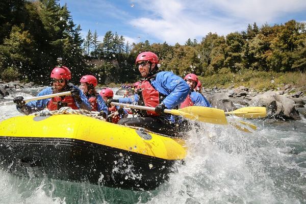
Grade 3 Rafting on the Tongariro: Blue Ducks, Volcanic Cliffs and Enormous Trout
Grade 3 rapids that take complete beginners, on a river where endangered blue ducks nest on the banks and the trout are big enough to eat a mouse.
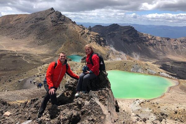
Guided Tongariro Crossing: 19 km, 8 Hours, Past the Mountain That Played Mount Doom
The guide reads the weather and track conditions as the day goes and times the pick-up to when the group actually gets down, not to a fixed schedule.
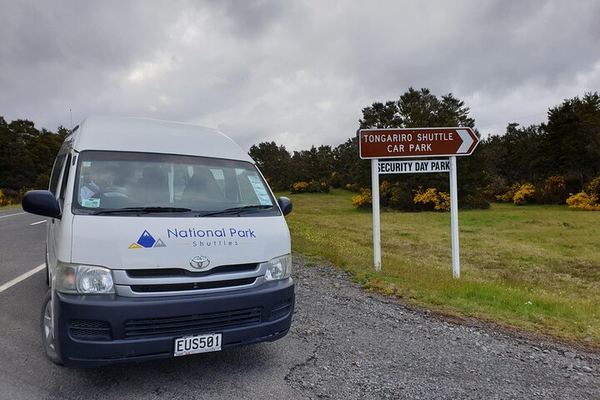
Park at the Finish: Ketetahi Carpark and a One-Way Lift to the Tongariro Start
You leave the car at the finish and get driven round to Mangatepopo, so there is no shuttle to catch at the end whether you walk it fast or slowly.
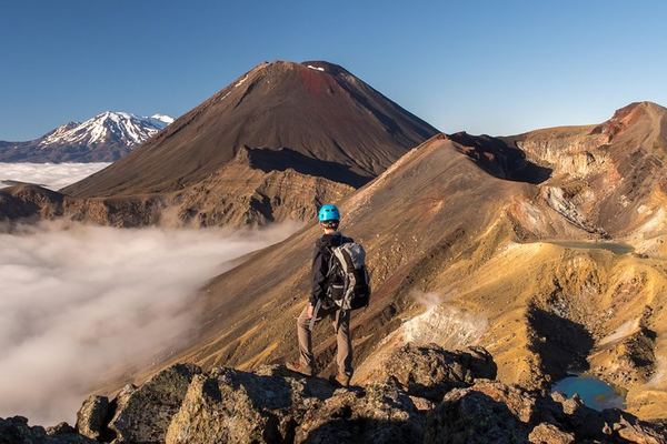
Private Tongariro Crossing with Adrift: Crampons and Ice Axes Supplied in Winter
Adrift supplies crampons and ice axes for the winter route and teaches their use on the day, and lunch and NZ$40 of gear hire come with the private guide.
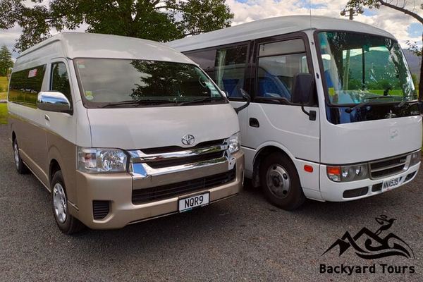
Tongariro Crossing Return Transfer from Turangi: 5.30am Out, 2.30pm Back
The van leaves Turangi at 5.30am and collects at 2.30pm, so the crossing fits between them. Walking poles, safety photos and a cold drink at the end included.
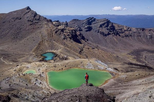
Tongariro Crossing Shuttle from Turangi: Secure Parking, Mangatepopo to Ketetahi
Māori operators from Turangi run the one-way transfer to Mangatepopo, with a blessing before you start and free safety photography as a record of the walk.
Ratings collected by Viator and Tripadvisor
The shape of the day
Nobody publishes a segment breakdown, which is odd, because on the day the only question that matters is whether you will make your shuttle. The two intermediate distances in the official material are the Emerald Lakes at about kilometre 9 and Blue Lake at about 10.5. The rest can be reconstructed from them, and it is more use than a single total.
| Section | Cumulative | Typical time | What it is |
|---|---|---|---|
| Mangatepopo car park to Soda Springs | 4.6 km | 1 to 1.5 hours | Almost flat, on boardwalk over old lava. The easy part |
| Soda Springs to South Crater | 6.4 km | 1 to 1.5 hours | The Devil's Staircase. Most of the day's climbing, in one go |
| South Crater to the Red Crater, 1,886 m | 8.4 km | about 1 hour | A flat crater floor, then an exposed ridge. Where wind turns people back |
| Red Crater down to the Emerald Lakes | 9 km | about 30 minutes | A steep descent on loose scoria. Sit down rather than fight it |
| Emerald Lakes to Blue Lake | 10.5 km | about 30 minutes | Level, past the Central Crater. Both lakes are wāhi tapu |
| Blue Lake to the Ketetahi shelter | 13 km | about 1 hour | Long descending traverse with the whole northern view open |
| Ketetahi shelter to the road end | 19.4 km | 2 to 2.5 hours | Endless zigzags, then bush. Where knees fail and schedules slip |
The climb is front-loaded and the descent is long. Nearly half the distance comes after Blue Lake, all of it downhill, and that is where the time goes. People plan around the ascent and get caught by the last six kilometres.
Two ways of counting the climb are in circulation and both are honest. DOC publishes plus or minus 1,196 metres, which is the sum of every ascent and descent on the route. The net figures are about 765 metres of climbing and 1,125 of descent. The distance has the same problem: 19.4 kilometres in the DOC material and most guidebooks, 20.2 on the regional tourism site. Plan for the larger number and nothing will surprise you.
Why the shuttle is not optional
This is where most planning goes wrong, and much of the internet is still wrong about it.
Nearly every article about the Crossing says there is a four-hour parking limit at the Mangatepopo end, in force from mid-October to April. That was true once. It is not what DOC says now. The current wording on its own page is flat: during the summer there is no parking for visitors doing the Tongariro Alpine Crossing at Mangatepopo car park. Not a limit, none at all. A regional tourism site and a widely read walking blog that claims to have verified everything in late 2025 both still publish the old rule.
At the other end, the Ketetahi car park is a four-hour car park, and the walk takes six to nine. So there is no lawful way to leave a vehicle at either end for the length of the crossing. Shuttles run from all the local towns, Whakapapa, National Park, Tūrangi, Raetihi, Ohakune, Taumarunui and Taupō, at roughly NZD 50 to 55 return, departing around 5:45, 7:15, 8:30 and 9:45 with returns between 13:30 and 17:30. The last pickup is 18:00 and being on it costs extra.
There is a third arrangement worth knowing about, because it solves the problem from the other direction: one operator runs a private secure car park on State Highway 46 at the Ketetahi end and drives you to the start, so your own car is waiting where you finish. The catch is in their own description and nobody else repeats it. You come off the track at the public four-hour car park and then walk a further 900 metres to reach the private one. After nineteen kilometres that is a longer 900 metres than it sounds.
The booking is free, and almost everyone describes it wrongly
There is a DOC track booking. It is not a permit, there is no quota, and in DOC's own words there is no cost to book. It is required if you are using a shuttle or a guided service, recommended for everyone else, and its purpose is knowing who is on the mountain.
A well-known competitor page calls it a mandatory permit, which manages to be wrong twice: it is not a permit, and for an independent walker arriving on foot it is not mandatory. The more useful thing nobody says is this: if you book a shuttle, the shuttle operator makes the track booking for you. You do not need to do it twice, and you certainly do not need to pay a third party to do it.
The weather rule, and the trap inside it
DOC assesses conditions at 6:00 every morning and issues a Not Recommended Today advisory if, in any two-hour window between 9:00 and 17:00, the forecast breaches one of five thresholds. Those thresholds are published and almost never quoted anywhere.
| Condition | Threshold |
|---|---|
| Mean wind speed | 55 km/h |
| Wind gusts | 70 km/h |
| Wind chill | −10 °C |
| Rainfall intensity | 2.5 mm per hour |
| Rainfall accumulation | 10 mm over 6 hours |
Now the part that matters. That advisory is issued in the summer season only. Between May and October, when the track is at its most dangerous, no advisory is issued at all. A walker who checks the page in June, sees no warning and concludes the mountain is fine has read the silence exactly backwards.
In those months DOC reclassifies the Crossing from a track to a route and states that alpine skills are essential. The equipment list becomes crampons, ice axe and helmet, plus an avalanche transceiver, probe and shovel, and there are 9 to 11 hours of daylight to do a 9-hour walk in.
| 1 | 2 | 3 | 4 | 5 | 6 | 7 | 8 | 9 | 10 | 11 | 12 |
The fires, and the rāhui
DOC has carried an alert at the top of the Crossing page since the 2025 fires and it is still there. Two fires burned significant areas of Tongariro National Park, including the ground around the start of the walk, and the landscape at the Mangatepopo end is blackened with regrowth only beginning. No competitor page mentions this, and people arrive expecting the photographs.
The second half of that notice matters more. Hapū Ngāti Hikairo ki Tongariro have placed a ten-year restorative rāhui over the affected areas. A rāhui is a protective restriction with customary and legal weight rather than a request, and it is the landowners deciding how their whenua recovers. The peaks of this park were handed to the Crown in 1887 by Horonuku Te Heuheu Tūkino IV of Ngāti Tūwharetoa precisely to stop them being sold off and broken up, which is how New Zealand acquired its first national park seven years later. The relationship between the iwi and this mountain is the oldest thing on this page and it is still operative.
What you cannot do here
Mount Ngauruhoe is the perfect cone in every photograph of this walk and the one the Lord of the Rings films used for Mount Doom. It is sacred, and both the local iwi and DOC ask people not to climb it. The route passes its base; the side trip to the summit is on no legitimate guided itinerary, and the scree on it is in poor condition from the years when it was.
The Emerald Lakes and Blue Lake are wāhi tapu, sacred sites. DOC's instruction is direct: stay on the marked track and do not touch or enter any of the lakes. That includes not putting a hand in for a photograph and not sitting at the water's edge to eat, which is exactly what the flat ground beside them invites you to do. There is a rock shelf slightly above them that is the appropriate place to stop.
Respect the sanctity of the maunga tapu by not touching or entering any of the waterways.
What it costs, and the listing that is not the walk
| What you book | Price | How long | Rating |
|---|---|---|---|
| One-way shuttle from a private secure car park at Ketetahi | 31 EUR | 35-minute transfer | 4.7 over 71 |
| Secure parking plus one-way shuttle | 35 EUR | transfer only | 4.8 over 53 |
| Round-trip transfer from Tūrangi | 42 EUR | transfer only | 4.9 over 76 |
| Grade 3 whitewater raft on the Tongariro River | 104 EUR | half day | 5.0 over 72 |
| Guided group crossing, all winter equipment included | 235 EUR | 8 hours | 4.7 over 270 |
| Private guided crossing | 704 EUR | 8 hours | 4.5 over 30 |
One of those is not the walk at all. The grade 3 whitewater raft is on the Tongariro River, it rates 5.0 across 72 reviews, and it is a good half day that shares a name and a valley with the Crossing and nothing else. If you booked it thinking it was the volcano, better to catch that now than at the put-in.
Practical, and the things not for sale
There are toilets roughly every one to two hours of walking. There is no drinking water anywhere on the route and the streams are not potable, so carry two to three litres. There are no bins, so everything you bring comes out with you. Nothing is sold on the mountain: no food, no water, no coffee at the far end.
Start early even in summer. The 5:45 and 7:15 shuttles exist because the weather on the exposed ridge deteriorates through the afternoon more often than it improves, and because a 9:45 departure leaves no margin at all if the last six kilometres take longer than you thought. Book the walk for your first full day in the area rather than your last, so that a closure leaves you a second attempt rather than a story about the weather.
Questions people actually ask
Do I need a permit for the Tongariro Alpine Crossing?
No. There is a DOC track booking, it is free, and it is not a permit and not a quota. It is required if you use a shuttle or a guided walk and recommended for everyone else. If you book a shuttle, the operator makes the booking for you. Pages describing a mandatory paid permit are wrong on both counts.
Can I park at the start and walk back to my car?
No. DOC states there is no parking at Mangatepopo in summer for people doing the Crossing, and the Ketetahi car park at the far end is a four-hour car park against a six to nine hour walk. The route is one way and 25 kilometres of road separate the two ends. A shuttle is the only workable arrangement, and one operator solves it by parking you at the finish and driving you to the start.
How hard is it?
Long rather than technical, in summer. Nineteen and a half kilometres, about 765 metres of climbing concentrated in the Devil's Staircase, and a descent of over a kilometre spread across the second half. No scrambling and no exposure that requires hands. The two things that catch people are the loose scoria coming off the Red Crater and the last six kilometres of zigzags, which are where most of the lateness happens.
Can I do it in winter?
Yes, with alpine skills or a guide. From May to late October DOC reclassifies it from a track to a route and says alpine skills are essential: crampons, ice axe, helmet, avalanche transceiver, probe and shovel, on about 9 hours of walking in 9 to 11 hours of daylight. The important trap is that DOC does not issue its Not Recommended Today advisory in those months, so an absence of warning in June means nothing at all.
How do I know if it is going to be closed?
DOC assesses conditions at 6:00 each morning in the summer season and publishes a Not Recommended Today advisory if wind exceeds 55 km/h mean or 70 km/h gusting, wind chill drops below −10 °C, or rain reaches 2.5 mm an hour or 10 mm over six hours in any two-hour window between 9:00 and 17:00. Guided operators also publish a trip status, generally from the morning before. Outside the summer season no advisory is issued.
Can you climb Mount Ngauruhoe?
You are asked not to. It is sacred to the iwi whose land the park sits on, and both they and DOC discourage it. No legitimate guided walk includes it, the route goes round the base, and the scree is in bad condition after years of traffic. The photographs everyone wants of the cone are taken from the track anyway.
What are the Emerald Lakes and can I swim in them?
They are crater lakes coloured by dissolved minerals, sitting at about kilometre 9 below the Red Crater, and they are wāhi tapu, sacred sites. DOC asks visitors not to touch or enter any of the lakes, which covers swimming, paddling and putting a hand in for a photograph. They are also geothermally heated in places and acidic. Stop on the rock shelf above them.
Is one day enough for Tongariro?
One day for the walk, two days in the area. Weather closes this track often enough that arriving with a single available morning is how people end up leaving without doing it. Give it a spare day, and if the weather holds for the first attempt you have a free day for the river, Whakapapa, or the drive to Rotorua.
Data verified on. Distances, altitudes, classifications, booking rules, weather thresholds and the rāhui notice from the Department of Conservation. Prices, durations and ratings from the products on this site.