
There is no standard way to compare volcano climbs, which is odd, because there is one for almost everything else you might do outdoors. Ski runs have colours. Climbing has grades. Via ferrata have a scale. Volcanoes have adjectives, and the adjectives are written by whoever is selling the trip.
So the same word, moderate, gets attached to a 175-metre walk up a made path at Vesuvius and to a 600-metre climb on loose scoria that starts at half past three in the morning. Both are true from somebody's point of view. Neither helps.
What follows is our attempt at a fix: five measurable axes, a published formula, and a score for thirty-nine itineraries. You do not have to trust our judgement, because there isn't any. Take the numbers, apply the formula, and you will get what we got.
How the index works
Five axes. Each one is something you can look up or measure, and nothing depends on how anyone felt on the day.
| Axis | What it measures | Points |
|---|---|---|
| Ascent | Total metres climbed, including any re-ascent after a descent | 0 to 30 |
| Time | Hours actually moving, summed across all days | 0 to 20 |
| Altitude | Highest point reached, scored non-linearly because oxygen is | 0 to 25 |
| Terrain | From paved path to roped glacier travel | 0 to 20 |
| Night | Whether the walking happens in darkness, and on what ground | 0 to 5 |
Altitude is deliberately not proportional. The step from 2,000 to 3,000 metres costs five points; the step from 4,500 to 5,500 costs another five on top of twenty already accumulated. That reflects how oxygen availability actually behaves, and it is why a short walk at 4,600 metres outranks a long one at sea level.
Two overrides beat the arithmetic. If crampons and an ice axe are required by regulation, the itinerary is top band regardless of score. And anything requiring a night spent above 3,000 metres cannot fall below the second band, because sleeping at altitude is its own problem.
| Band | Score | Name | What it means |
|---|---|---|---|
| 1 | 0 to 14 | Volcanic walk | Anyone who walks, in any footwear |
| 2 | 15 to 29 | Hike | Proper shoes and half a day |
| 3 | 30 to 49 | Hard hike | Training helps. Without it, you will suffer but finish |
| 4 | 50 to 74 | Severe trek | Specific preparation. Not something to improvise |
| 5 | 75 to 100 | Mountaineering | Not a hike in any sense of the word |
The table
Sorted hardest first. Where a volcano offers more than one route, each route is scored separately, because on several mountains the routes differ more from each other than they do from other mountains.
| Itinerary | Highest point | Ascent | Hours | Score | Band |
|---|---|---|---|---|---|
| Mount Rainier summit, USA | 4,392 m | about 2,750 m | 2 days | 90 | 5 |
| Cotopaxi summit, Ecuador | 5,897 m | about 1,033 m from the refuge | 8 to 10 | 88 | 5 |
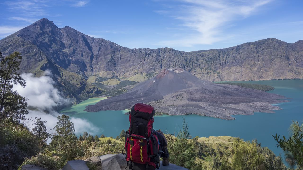
| Mount Rinjani summit 3D2N, Indonesia | 3,726 m | 2,600 m or more cumulative | 3 days | 78 | 5 |
| Mount Fuji, Gotemba route, Japan | 3,776 m | 2,336 m | about 12 | 78 | 5 |
| Villarrica, Chile | 2,860 m | about 1,400 m | 6 to 8 | 64 | 5 |
| Mount Agung from Besakih, Bali | 3,031 m | about 2,030 m | 10 to 12 | 73 | 4 |
| Acatenango overnight, Guatemala | 3,976 m | about 1,500 m | 8 to 12 | 72 | 4 |
| Volcan de Agua, Guatemala | 3,760 m | about 1,760 m | 8 to 10 | 69 | 4 |
| Mount Fuji, Yoshida route | 3,776 m | 1,471 m | about 10 | 67 | 4 |
| Mount Fuji, Subashiri route | 3,776 m | 1,776 m | about 10 | 67 | 4 |
| Rinjani crater rim 2D1N, Indonesia | about 2,641 m | about 2,040 m | 2 days | 65 | 4 |
| Mount Fuji, Fujinomiya route | 3,776 m | 1,376 m | about 8 | 61 | 4 |
| Mount St. Helens, Monitor Ridge, USA | 2,549 m | about 1,400 m | 7 to 12 | 59 | 4 |
| Etna on foot from Rifugio Sapienza, Italy | about 2,900 m | about 1,000 m | 5 to 7 | 58 | 4 |
| Teide from Montana Blanca, Spain | 3,715 m | about 1,360 m | 5 to 6 | 56 | 4 |
| Mount Agung from Pasar Agung, Bali | about 2,950 m | about 1,350 m | 7 to 9 | 51 | 4 |
| Montanha do Pico, Azores | 2,351 m | about 1,120 m | 6 to 8 | 51 | 4 |
| Tongariro Alpine Crossing, New Zealand | 1,886 m | 1,196 m | 7 to 9 | 43 | 3 |
| Etna summit craters with a guide | about 2,900 m | about 400 m | 3 to 4 | 42 | 3 |
| Quilotoa crater rim circuit, Ecuador | 3,915 m | undulating | 4 to 5 | 42 | 3 |
| Haleakala, Sliding Sands, Hawai'i | 3,055 m | about 760 m on the return | 5 to 7 | 42 | 3 |
| Kawah Ijen and the blue fire, Java | about 2,386 m | about 500 m | 4 to 5 | 40 | 3 |
| Cotopaxi, refuge only | 4,864 m | about 264 m | 1 to 2 | 36 | 3 |
| Quilotoa, down to the lake and back | 3,915 m | 280 m on the return | 2 to 3 | 36 | 3 |
| Mount Batur sunrise, Bali | 1,717 m | about 600 m | 4 | 35 | 3 |
| Mount Rainier, Skyline Trail | about 2,070 m | about 520 m | 4 to 6 | 32 | 3 |
| Santa Ana, El Salvador | 2,381 m | about 350 m plus re-ascent | 4 | 31 | 3 |
| Mount Tarawera, New Zealand | 1,111 m | moderate | 4 to 5 | 26 | 2 |
| Teide by cable car and the summit path | 3,715 m | 172 m | under 1 | 25 | 2 |
| Pacaya, Guatemala | about 2,552 m | moderate | 3 to 4 | 21 | 2 |
| Bromo crater from the sand sea, Java | 2,329 m | about 200 m | 1 to 2 | 19 | 2 |
| Stromboli to 400 m with a guide, Italy | 400 m | 400 m | 2 to 3 | 19 | 2 |
| Mauna Kea by road, Hawai'i | 4,207 m | none | under 1 | 15 | 2 |
| Kilauea Iki Trail, Hawai'i | about 1,200 m | 122 m | 2 to 3 | 15 | 2 |
| Haleakala sunrise at the viewpoint | 3,055 m | none | under 1 | 13 | 1 |
| Vesuvius, path number 5, Italy | 1,175 m | 175 m | about 2.5 | 10 | 1 |
| Thrihnukagigur, into the magma chamber, Iceland | sea level | minimal | 5 to 6 total | 10 | 1 |
| Hverfjall crater rim, Iceland | 420 m | about 140 m | under 1 | 5 | 1 |
| Kerid, Crater Rim Trail, Lagoa do Fogo | low | minimal | under 1 | 0 to 5 | 1 |
Five itineraries out of thirty-nine are genuine mountaineering, and all five require rope, crampons and an ice axe. At the other end, twelve sit in the two easiest bands, and five of those are easier than a walk in the countryside. And they all appear in the same search results, under the same words, described with the same adjectives.
Two notes on reading the table. It is sorted by band rather than strictly by score, so a 73 can appear below a 78: the band is the decision you are making, the score is how it got there. And the final row groups three short crater walks that score identically, which is why the count of rows and the count of places differ slightly.

The nine most underestimated
Ranked by the gap between what the index says and how the itinerary is usually sold.
Fuji by Gotemba
Score 78. Sold as the quiet route with no crowds. It is quiet because it is 2,336 metres of ascent and around twelve hours, nine hundred metres more than the shortest route up the same mountain.
Haleakala at sunrise
Score 13, and dangerous precisely because of that. You reach 3,055 metres by car, from sea level, in about two hours. No effort, no acclimatisation, and freezing wind at the top of a tropical island.
Mauna Kea
Score 15, at 4,207 metres. The same trick as Haleakala with another 1,150 metres on top. The official guidance rules out under-13s, pregnancy, heart and respiratory conditions, and anyone who has been diving in the past day.
Mount Batur at sunrise
Score 35, sold on Bali's beaches as an easy sunrise hike. Six hundred metres of loose scoria starting at half past three, bought by people on a swimming holiday.
Acatenango
Score 72, sold as an overnight camping trip. The climb is the advertised part. The unadvertised part is sleeping at around 3,600 metres, having arrived from the tropics the previous day.
Cotopaxi, refuge only
Score 36, sold as a forty-five minute walk. The forty-five minutes is accurate. It happens between 4,600 and 4,864 metres, where there is a little over half the oxygen you are used to.
Quilotoa down to the lake
Score 36, sold as a thirty-minute descent. The descent is thirty minutes. The return is 280 metres of climbing at nearly 3,900 metres and takes up to two hours, which you discover at the bottom.
Mount St. Helens
Score 59, officially described as non-technical. Correct and misleading: 1,400 metres of boulder-hopping and deep ash over seven to twelve hours with no shade anywhere.
Agung from Pasar Agung
Score 51, sold as the Agung summit. It is not the summit. It stops on the rim, several hundred metres short of Bali's high point, which needs the longer route from Besakih.
And one that runs the other way
Stromboli is the most overrated climb in this table, and it is not the operators' fault so much as the internet's.
The imagery in circulation is of the summit at over 900 metres, looking down on the Sciara del Fuoco. That has not been legal for years. The current mayoral ordinance permits guided ascent to 400 metres, and unguided walking to 290, with a fine for going higher and suspension from the professional register for any guide who allows it.
So the real product is a four hundred metre climb, which scores 19 and sits in band two. It is still worth doing, the volcano is still the most reliable in Europe, and the explosions are still watched from boats and from below. But if you booked it expecting the photograph, you booked something that no longer exists.
Access limits on Stromboli have changed several times in recent years and will change again. Check the ordinance in force, not the pictures.
What this table does not know
The weakest column is where the walking starts. Park authorities publish summit altitudes almost universally and trailhead altitudes almost never, so several ascent figures are calculated by difference and a few are approximate. Where a figure is genuinely uncertain we have written about rather than inventing a decimal place.
The index also deliberately ignores three things that matter and cannot be scored: weather on the day, which can turn band two into an epic; how good your guide is, which changes the experience more than any of the five axes; and how you personally respond to altitude, which is not predictable from fitness and has embarrassed a great many strong walkers.
Use it to avoid booking the wrong end of the spectrum. Do not use it to decide you are fine.
Quick answers
What is the hardest volcano climb in the world for a tourist?
Of the ones ordinary travellers actually book, Cotopaxi and Mount Rainier, both of which are glacier ascents requiring rope, crampons and an ice axe. They are not hikes. Among non-technical routes, Rinjani's three-day summit trek and the Gotemba route on Fuji are the most demanding.
Which volcano is best for someone who has never hiked?
Vesuvius, which is a 175 metre climb on a prepared path, or the Kilauea Iki trail in Hawai'i, which crosses the floor of a solidified lava lake. Both are genuinely remarkable and neither requires any preparation beyond decent shoes.
Is Acatenango really that hard?
Yes, and the hard part is not where people expect. The ascent is around 1,500 metres of loose ash, which is tiring but finite. The difficult part is spending a night at roughly 3,600 metres, often having arrived in Guatemala within the past day or two. Most of the reported misery is altitude and cold, not the walking.
Do I need a guide?
On several of these you do, and the reason varies. On Etna it is a zone-based civil protection rule. On Stromboli it is a mayoral ordinance with a fine attached. On Villarrica you need either a guide or documented mountaineering credentials. On Batur it is enforced by the local guides' association rather than by law. On Fuji and Tongariro no guide is required at all.
Can I reuse this scale for a volcano you have not listed?
Yes, that is the point of publishing the formula. Take the ascent, moving hours, maximum altitude, terrain type and whether it runs at night, score each on the tables above, and add them up. If you tell us what you get we will happily add the row.
Band one and two, if you want the volcano without the suffering
Vesuvius is 175 metres on a made path, and the crater is the same one that buried Pompeii in 79 AD.
The easiest crater in this table
Vesuvius is band one: 175 metres of ascent on a made path, and the crater is the one that buried Pompeii.
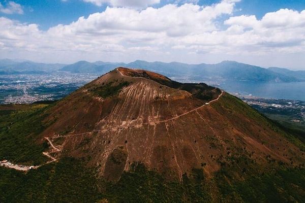
Vesuvius from Naples Central: Bus, Crater Ticket and an Audio Guide on Your Phone
Everything is collected at one desk inside Napoli Centrale, and the crater admission is skip-the-line, so the walk up runs at whatever pace you want.
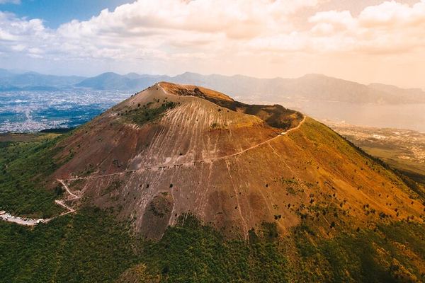
Vesuvius from the Gates of Pompeii, Bus and Crater Ticket Included
Departure from Porta Marina Superiore at the Pompeii gate, with the crater ticket, the return bus and a guide all in one booking. The Gulf of Naples below.
Ratings collected by Viator and Tripadvisor

Data verified on. Altitudes, distances and access rules come from park authorities, mapping agencies and published ordinances. Uncertain figures are marked as approximate rather than guessed. Editorial Policy