

Volcano Tours in Ecuador
Two volcanoes carry the whole market and neither one is erupting. What tests you is the two thousand metres between Quito and the Cotopaxi refuge, gained in a morning.
Ecuador is a country the size of Nevada with an unbroken line of volcanoes down the middle of it. Two of them are erupting as this is written, and the visitor market sells neither. What it sells instead is a quiet 5,897 m cone with a glacier on it and a caldera full of green water, both within a day of Quito, and the thing that decides whether you enjoy either has almost nothing to do with volcanology. It is the altitude, and the numbers are worse than they look.
This page is about the country: the corridor the volcanoes sit in, why the market picked these two out of a much longer list, and how the altitude actually stacks up hour by hour. The detail of the two destinations, what the refuge walk is like and what the crater descent costs, is on the Cotopaxi and Quilotoa page below.
Choose a destination in Ecuador

Volcano Travel Experiences in Ecuador
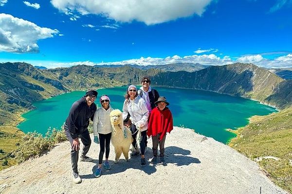
Cotopaxi and Quilotoa in Ten Hours, Through Pujilí and Zumbahua
Ten hours covers both: an hour and a half to Cotopaxi, two more to Quilotoa, through the Panzaleo villages, with the descent to the water optional.
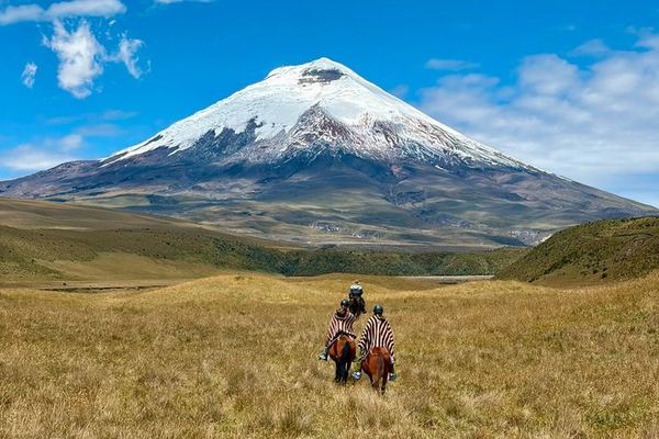
Cotopaxi from the North Gate: an Hour on Horseback with the Chagras, Then Base Camp
The north gate keeps the crowds off, the first hour is ridden with the Chagras, and lunch is eaten at 4,900 m instead of on the way out of the park.
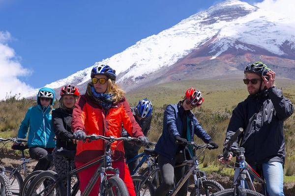
Cotopaxi Hike and Bike: Up to the Refuge, Down to Limpiopungo on Two Wheels
The walk reaches the refuge at 4,897 m and the way back down to the Limpiopungo lagoon is done on a bicycle, from a 7:10 a.m. pick-up in Quito.
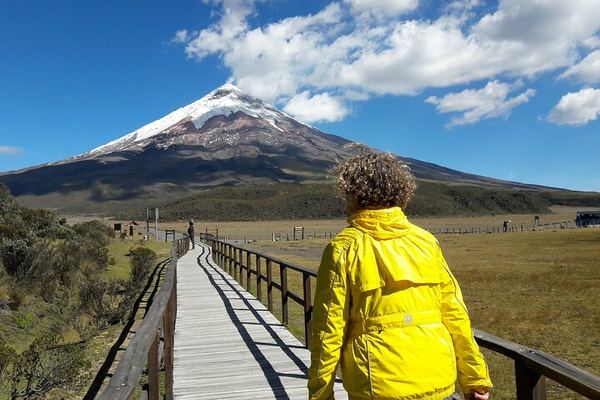
Cotopaxi, the 'Moon Neck': the Refuge Built by a Priest and His Students
The name means moon neck, for the shape of the cone, and the refuge an hour above the car park was built in the 1970s by a priest and his climbing club.
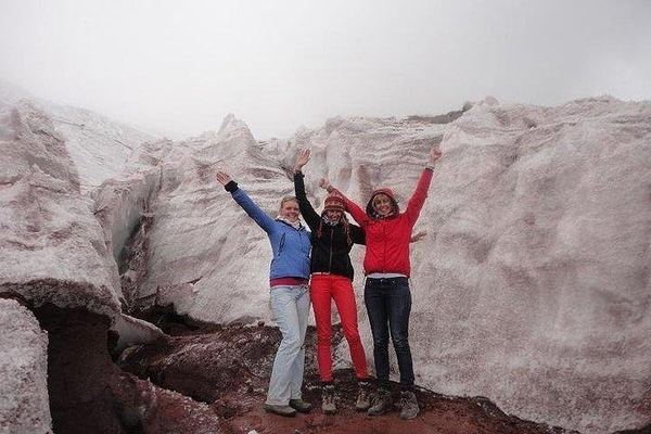
Cotopaxi: the Padre Rivas Refuge and, If You Can, the Glacier at 5,050 m
Above the refuge at 4,830 m the walk can continue to the glacier at 5,050, depending on how you are going, with llamas and deer at the lagoon below.
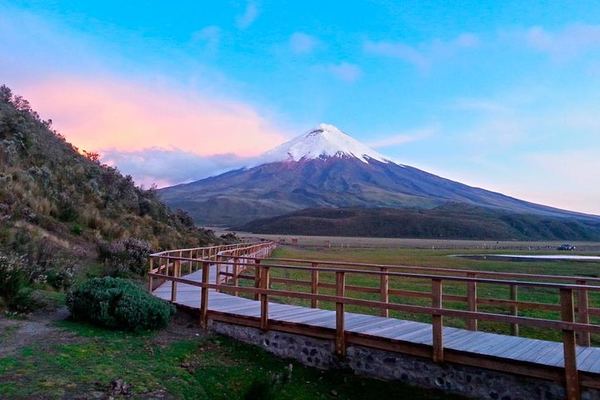
Cotopaxi to the José Rivas Refuge at 4,864 m, with Limpiopungo Lagoon
The walk goes to the refuge at 4,864 m on a volcano of 5,897, with the Limpiopungo lagoon and the interpretation centre before it. Entrances included.

Otavalo Market, the Peguche Waterfall and the Ñanda Mañachi Musicians
The stops run from the equator line and a bizcocho bakery to the market at Otavalo, the sacred waterfall at Peguche and a family band in their own house.
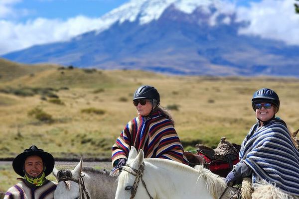
Private Cotopaxi for Beginners: Highland Riding and the Walk to 4,864 m
The riding and the walking are both pitched at first-timers, and the high point is the José Ribas refuge at 4,864 m, on a private booking from Quito.
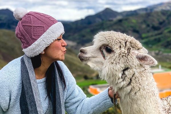
Quilotoa Crater Lake: the Descent Is Easy, the Climb Back Is Not
Walking down to the water is the easy half; the community rents mules on the rim for the climb back, and Tigua's painters are on the road home.
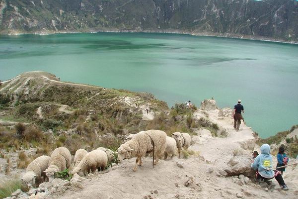
Quilotoa's 1280 Caldera and the Avenue of Volcanoes, from Quito
The caldera is three kilometres wide and dates from the eruption of 1280, and the road to it runs the whole length of the Avenue of Volcanoes.
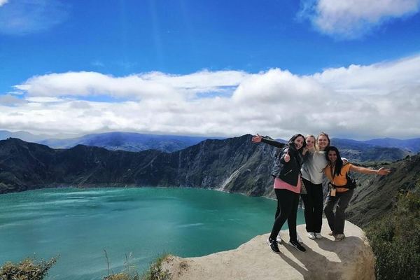
Quilotoa with Breakfast, a Guided Descent and a Return to Quito by 8pm
Breakfast on the way out, a guided walk down to the water rather than a look from the rim, and Quito again by about 8pm after four hours on the road.
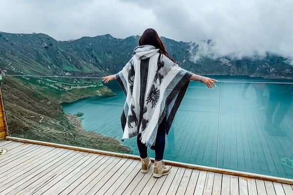
Three Days: Cotopaxi's Coca Tea, Quilotoa, and the Swing at Baños
Hotels, meals and the hot springs are booked separately, and the order of the days can change: the final itinerary comes through the day before.
Ratings collected by Viator and Tripadvisor
The Avenue of the Volcanoes
The name is not a marketing invention. Alexander von Humboldt coined it in 1802, travelling the corridor between Ecuador's two Andean cordilleras and finding a line of snow-capped cones on both sides of him for hundreds of kilometres. The geology behind it is straightforward: the Nazca plate slides eastward under South America, and the melt it generates rises in a band that runs roughly north to south through the middle of the country. Quito sits inside that band, on the skirts of Guagua Pichincha, which dropped ash on the city in 1999 and last erupted in 2002.
The Instituto Geofísico of Ecuador's national polytechnic maintains hazard pages for sixteen mainland volcanic systems, which is a reasonable measure of how many are considered live enough to watch. Two are erupting now and have been for years: Sangay, in the eastern cordillera with no road to it, and El Reventador in the Amazon foothills, which has been in near-continuous activity since 2002. Neither appears in any tour catalogue, including this one, and the reason is access rather than danger. You cannot build a day trip around a volcano with no road.
| Volcano | Height | Most recent eruption | Sold here |
|---|---|---|---|
| Chimborazo | 6,261 m | Around 550 CE | None |
| Cotopaxi | 5,897 m | October 2022 to July 2023 | 8 listings |
| Sangay | 5,286 m | Erupting continuously | None |
| Tungurahua | 5,023 m | 2016 | 1, as a stop on a three-day trip |
| Quilotoa | 3,914 m | Around 1280 | 4 listings |
| Guagua Pichincha | 4,784 m | 2002 | None, though Quito is built on it |
Chimborazo deserves its own line. It has not erupted since roughly the sixth century and is not on anybody's tour list, but its summit is the point on the Earth's surface furthest from the centre of the planet. The Earth bulges at the equator by about 21 km, and Chimborazo sits a degree and a half south of it. Everest is higher above sea level and Chimborazo is further out into space, which is the kind of fact that survives a long bus journey.
Altitude is the actual subject
Almost every complaint about an Ecuadorian volcano day is a complaint about height, and almost every itinerary understates it. Quito already sits at 2,850 m, which is roughly the altitude of the highest ski lifts in the Alps, and most visitors arrive there from sea level the day before. From that baseline, a standard Cotopaxi day trip drives to a car park at 4,500 m and walks to a refuge at 4,864 m. That is two thousand metres of net gain inside one morning, on a body that has had perhaps thirty-six hours to adjust.
The tour descriptions handle this in one line, usually a note that a moderate level of fitness is required. Fitness is not the variable. Acclimatisation is, and it does not respond to training. A marathon runner who flew in on Tuesday will suffer more at the refuge than a sedentary traveller who has spent a week in Quito.
| Where | Height | What happens there |
|---|---|---|
| Quito | 2,850 m | Where you sleep, and already high enough to affect the first night |
| Limpiopungo lagoon, Cotopaxi National Park | About 3,800 m | The photo stop, and where most people first notice it |
| Quilotoa crater rim | 3,810 to 3,915 m | The viewpoint; the lake is 3,500 m and the walk back up is the hard part |
| Cotopaxi car park | 4,500 m | As high as the vehicle goes |
| José Ribas refuge | 4,864 m | 45 to 60 minutes on foot, about 350 m of climbing on volcanic sand |
| Glacier edge | About 5,000 m | Beyond the refuge; this is where a certified guide becomes compulsory |
One misconception worth clearing here, because it costs people money. A certified mountain guide is required for the glacier and the summit, not for the national park or the refuge walk. The refuge is reached on an ordinary tourist day trip with an ordinary tour guide, and the products that sell it as an achievement are describing a 45 to 60 minute uphill slog on loose sand, which is quite enough at that height without inflating it.
What the twelve listings are
Every one of them starts in Quito, which is unusual and tells you something: Ecuador's volcano market has no second hub. Seven go to Cotopaxi, three to Quilotoa, one does both in a single day of about ten hours, and one is the Otavalo market with a distant view of Cayambe, which is a fine day out and is not a volcano tour whatever the category says.
| What you book | Listings | Price | Rating |
|---|---|---|---|
| Cotopaxi day trip with park entry | 4 | 52 to 78 EUR | 4.7 to 5.0 |
| Quilotoa day trip with entry fees | 3 | 52 to 78 EUR | 4.8 to 4.9 |
| Cotopaxi with horses or bikes | 3 | 71 to 172 EUR | 4.9 to 5.0 |
| Both volcanoes in one day | 1 | 212 EUR | 4.9 |
| Three days with Baños and the Andes | 1 | 211 EUR | 4.9 |
The one-day double is the listing to think hardest about. Cotopaxi and Quilotoa are on opposite sides of the corridor, and doing both in a day means roughly ten hours of which a large share is the road. It costs 212 EUR against 52 for either one on its own, and the arithmetic only works if this is genuinely the last day in the country. Two separate days at 52 and 60 EUR come to less than half the price and involve half as much minibus.
If you have three days in Quito, spend the first one at 2,850 m doing nothing strenuous, the second at Quilotoa, and the third at Cotopaxi. Reverse that order and you will spend the trip's high point with a headache.
When to come
The equator does not give Ecuador a summer and a winter, it gives it a wet season and a less wet one, and the difference matters more than the temperature. June to September is the drier, windier stretch in the sierra and the best odds of seeing a cone rather than the cloud it lives in. February to April is the wettest, and rain is not a cosmetic problem here: the landslide that dropped into the Quilotoa lake in March 2026 was triggered by weeks of heavy rain rather than by the volcano.
| Month | 1 | 2 | 3 | 4 | 5 | 6 | 7 | 8 | 9 | 10 | 11 | 12 |
|---|---|---|---|---|---|---|---|---|---|---|---|---|
| Cotopaxi National ParkClear mornings are commonest in the June to September dry spell; February to April keeps the cone in cloud | 1 | 2 | 3 | 4 | 5 | 6 | 7 | 8 | 9 | 10 | 11 | 12 |
| Quilotoa craterRain makes the crater path slick and was behind the March 2026 landslide; driest June to September | 1 | 2 | 3 | 4 | 5 | 6 | 7 | 8 | 9 | 10 | 11 | 12 |
Months as numbers. Based on the Andean sierra's dry and wet seasons and on operator schedules; the volcanoes themselves are open all year.
Questions people actually ask
Is Cotopaxi erupting right now?
No. Its last eruptive phase ran from 21 October 2022 to 6 July 2023 and it has produced no ash since. Ecuador's geophysical institute described activity as low and unchanged in its July 2026 reporting, with fumarolic emission continuing, which is the volcano's normal background. Two other Ecuadorian volcanoes are erupting, Sangay and El Reventador, and neither is anywhere near a tour route.
Do I need a guide to go to Cotopaxi?
Not for the national park or the walk up to the José Ribas refuge at 4,864 m, which is what almost every listing sells. A certified mountain guide is required above that, for the glacier and the summit, and that is a separate mountaineering product with a night start and technical equipment.
How bad is the altitude?
Bad enough that it is the main thing to plan around. Quito is 2,850 m, the Cotopaxi car park is 4,500 m and the refuge is 4,864 m, all inside a single morning. Headache and breathlessness at the refuge are normal rather than a sign of anything wrong. Spend a night or two in Quito first, drink more water than feels sensible, and treat the walk to the refuge as slow rather than short.
Cotopaxi or Quilotoa, if I can only do one?
Cotopaxi if you want a volcano that looks like a volcano, with a glacier, a crater and a refuge to walk to. Quilotoa if you want the water: a caldera three kilometres across with a green lake 250 m deep in it, and a descent to the shore that is easy going down and a serious hour or two coming back. Both are day trips from Quito at around the same price.
How much does a volcano tour in Ecuador cost?
Between 52 and 78 EUR for a full day to either volcano with entrance fees included, which is the price band nine of the twelve listings sit in. Horseback and cycling variants run 71 to 172 EUR. Above that you are buying either both volcanoes in one day at 212 EUR, or three days with Baños at 211.
When is the best time of year?
June to September, for the drier and windier sierra weather that clears the cones. February to April is the wet stretch and the cloud tends to sit on the mountain all day. Being on the equator, the temperature barely changes across the year; what changes is whether you can see anything.
Is it safe to visit an active volcano in Ecuador?
Under the current level of activity, yes, and the monitoring is serious: the first permanent seismic station dedicated to a volcano anywhere in South America was installed on Cotopaxi in 1976. The caution worth taking seriously comes from the institute itself, which points out that the neighbourhood of a volcano can be hazardous even when it is not erupting. The October 2022 eruption began without obvious warning and dropped material on the refuge, and everyone in it was brought down the same day.
Data verified on. Volcano status, heights and eruption dates from Ecuador's Instituto Geofísico (IG-EPN). Prices, ratings and itineraries read from the Ecuadorian products on this site.