

Cotopaxi and Quilotoa Tours from Quito
Twelve day trips between 52 and 212 EUR. Walking down to the Quilotoa lake takes thirty minutes and walking back up takes two, which no product page mentions.
These two share a page because they share a starting point, and that is genuinely all they have in common. Cotopaxi is a 5,897 m cone with a glacier on it, an active volcano that was erupting three years ago, and the day there is a drive up to 4,500 m and a walk to a refuge. Quilotoa is a hole in the ground three kilometres wide with 250 m of green water in the bottom of it, last erupted around 1280, and the day there is a descent and, more to the point, a climb back out. Both are sold from Quito for around the same money, and people book the wrong one all the time.
What follows is the operational part: what each day actually consists of, which listings include what, three things the product pages get factually wrong, and the two events of March 2026 that changed what the monitoring agency says about both mountains. The wider picture of Ecuador's volcanic corridor and how the altitude compounds across a trip is on the Ecuador page above.
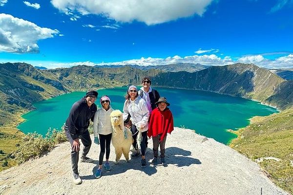
Cotopaxi and Quilotoa in Ten Hours, Through Pujilí and Zumbahua
Ten hours covers both: an hour and a half to Cotopaxi, two more to Quilotoa, through the Panzaleo villages, with the descent to the water optional.
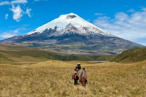
Cotopaxi from the North Gate: an Hour on Horseback with the Chagras, Then Base Camp
The north gate keeps the crowds off, the first hour is ridden with the Chagras, and lunch is eaten at 4,900 m instead of on the way out of the park.
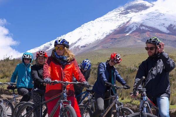
Cotopaxi Hike and Bike: Up to the Refuge, Down to Limpiopungo on Two Wheels
The walk reaches the refuge at 4,897 m and the way back down to the Limpiopungo lagoon is done on a bicycle, from a 7:10 a.m. pick-up in Quito.
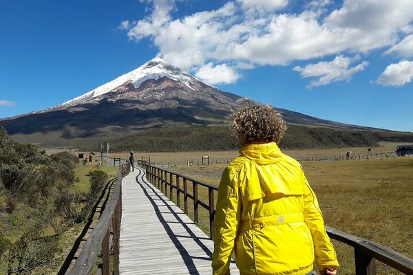
Cotopaxi, the 'Moon Neck': the Refuge Built by a Priest and His Students
The name means moon neck, for the shape of the cone, and the refuge an hour above the car park was built in the 1970s by a priest and his climbing club.
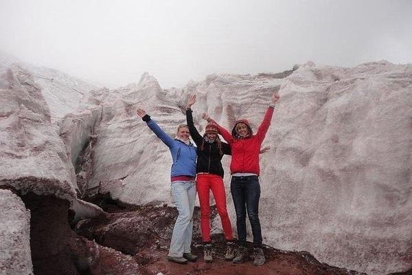
Cotopaxi: the Padre Rivas Refuge and, If You Can, the Glacier at 5,050 m
Above the refuge at 4,830 m the walk can continue to the glacier at 5,050, depending on how you are going, with llamas and deer at the lagoon below.
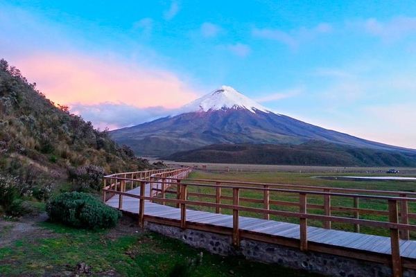
Cotopaxi to the José Rivas Refuge at 4,864 m, with Limpiopungo Lagoon
The walk goes to the refuge at 4,864 m on a volcano of 5,897, with the Limpiopungo lagoon and the interpretation centre before it. Entrances included.

Otavalo Market, the Peguche Waterfall and the Ñanda Mañachi Musicians
The stops run from the equator line and a bizcocho bakery to the market at Otavalo, the sacred waterfall at Peguche and a family band in their own house.
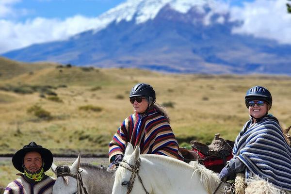
Private Cotopaxi for Beginners: Highland Riding and the Walk to 4,864 m
The riding and the walking are both pitched at first-timers, and the high point is the José Ribas refuge at 4,864 m, on a private booking from Quito.
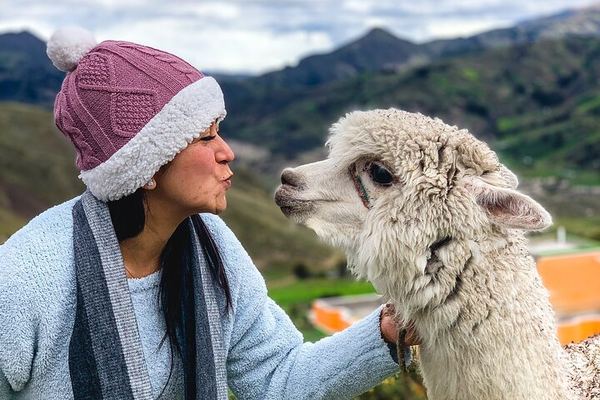
Quilotoa Crater Lake: the Descent Is Easy, the Climb Back Is Not
Walking down to the water is the easy half; the community rents mules on the rim for the climb back, and Tigua's painters are on the road home.
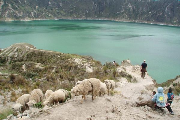
Quilotoa's 1280 Caldera and the Avenue of Volcanoes, from Quito
The caldera is three kilometres wide and dates from the eruption of 1280, and the road to it runs the whole length of the Avenue of Volcanoes.
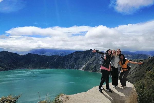
Quilotoa with Breakfast, a Guided Descent and a Return to Quito by 8pm
Breakfast on the way out, a guided walk down to the water rather than a look from the rim, and Quito again by about 8pm after four hours on the road.
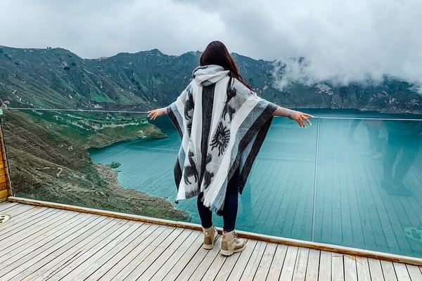
Three Days: Cotopaxi's Coca Tea, Quilotoa, and the Swing at Baños
Hotels, meals and the hot springs are booked separately, and the order of the days can change: the final itinerary comes through the day before.
Ratings collected by Viator and Tripadvisor
Two volcanoes, two completely different days
The single most useful thing to settle before booking is which of these two you actually want, because the marketing photographs look interchangeable and the days are not. One is high and cold and mostly about a vehicle taking you up. The other is lower, warmer and entirely about your own legs.
| Cotopaxi | Quilotoa | |
|---|---|---|
| What it is | Active stratovolcano with a glacier | Caldera 3 km across with a lake in it |
| Distance from Quito | About 45 km, roughly 2 hours by road | 83 km, about 3 hours by road |
| Highest point you reach | 4,864 m, the José Ribas refuge | 3,915 m on the crater rim |
| The walking | 45 to 60 minutes up, about 350 m of gain | 30 minutes down, 1 to 2 hours back up, 280 m |
| Most recent eruption | 21 October 2022 to 6 July 2023 | Around 1280 |
| Cheapest listing here | 52 EUR with entrances | 52 EUR with entrances |
| What makes it hard | The altitude, immediately | The climb out, at the end of the day |
Cotopaxi: the drive, the car park, the refuge
A standard Cotopaxi day is twelve hours from a Quito hotel and follows the same shape in every listing. Two hours south on the Panamericana, into the national park, a stop at the Limpiopungo lagoon at around 3,800 m with the cone reflected in it if the cloud is co-operating, sometimes a visit to the Mariscal Sucre interpretation centre, then the climb by road to the car park at 4,500 m.
The car park is where the day becomes real. From there it is 45 to 60 minutes on foot to the José Ribas refuge at 4,864 m, about 350 m of ascent on loose volcanic sand at a height where most visitors have never been. Two of the listings quote that altitude in their own text, and one of them adds the figure in feet, which is 15,958. For comparison, Mont Blanc's summit is 4,808 m. You are walking, in trainers, to a point higher than the highest mountain in western Europe, having woken up that morning at 2,850 m.
The refuge has been there since 1971 and sells hot drinks. That is the top of the tourist product. Above it the glacier begins at around 5,000 m and everything from that point is mountaineering: a certified guide, a night start, crampons and a rope. The park itself takes somewhere between a hundred thousand and a quarter of a million visitors a year, and the overwhelming majority of them stop at the refuge or below it.
Three things the listings get wrong
The refuge is called José Ribas, not Rivas. The misspelling is in tour descriptions, in guidebooks and in a good half of what a search returns. It is a small thing and it is a reliable tell that a page was copied rather than written.
The guide requirement is routinely oversold. A certified mountain guide is compulsory for the glacier and the summit. It is not required for the national park, the Limpiopungo lagoon or the walk up to the refuge, all of which are done on ordinary day trips with ordinary tour guides. Listings that imply otherwise are selling the summit's rules with the refuge's itinerary.
The entrance fee is disputed. Three separate sources give entry to Cotopaxi National Park as free, and several product pages state that ten US dollars is payable in cash at the gate. We cannot reconcile those, so we are telling you both: budget ten dollars in cash per person, be pleased if nobody asks for it, and treat a listing that says entrances are included as having settled the question either way. Most of the cheaper listings, at 52 to 78 EUR, say exactly that.
What these two volcanoes have done, and when
Five eruptive periods on one, a single enormous one on the other, and two events in March 2026 that put both back in the monitoring reports.
The origins
c. 1280
Quilotoa's last eruption
The most recent of at least eight large eruptions over 200,000 years, several of them in the VEI 4 to 6 range. The white pumice in the road cuttings around the crater is the debris. The caldera left behind is what now holds the lake.
1532-1534
Cotopaxi's first recorded period
The earliest of five major eruptive periods documented since the Spanish conquest. The others run 1742-1744, 1766-1768 and 1853-1854.
1797
The Riobamba earthquake shakes Quilotoa
The shock triggers a limnic eruption: gases accumulated at the bottom of the lake are released violently. Nobody is killed, but when villagers from Isinlivi climb up days later they find the water bubbling, foul gas in the crater, and every animal grazing inside it dead.
The growth
1877-1880
The eruption everyone plans around
Cotopaxi's largest historical period. Hot material meets the glacier and generates lahars that reach the inter-Andean valley. It remains the reference scenario: more than 300,000 people now live in the zones those mudflows would cross.
1976
The first permanent volcano seismometer in South America
Installed on Cotopaxi. The network around it has grown continuously since, and the volcano is now among the most heavily instrumented on the continent.
Today
2022-2023
Ash on the refuge
On 21 October a small ash emission arrives with no obvious warning and drops gravel on the José Ribas refuge. Most of the occupants are evacuated the same day. The eruptive phase that begins there runs until 6 July 2023 and produces about half the ash of the 2015 episode despite lasting longer.
March 2026
A landslide and an avalanche
On 12 March about 20,000 cubic metres of rock slides into the Quilotoa lake and sets off waves that reach the jetty. On 14 March a snow avalanche comes off Cotopaxi's Yanasacha fumarole field. Neither is volcanic in origin, and both prompt reinforced monitoring.
Quilotoa: thirty minutes down, two hours up
Quilotoa is three hours from Quito on roads that climb the whole way, inside the Los Ilinizas ecological reserve, between the villages of Zumbagua and Sigchos. You arrive at the rim, somewhere between 3,810 and 3,915 m depending on where you stand, and the caldera opens in front of you: three kilometres across, a lake 250 m deep, and a colour that runs from jade to turquoise depending on the light.
Then there is the decision. The path to the water drops 280 m and takes about thirty minutes, on sand. Coming back up takes one to two hours for most people, on the same sand, at very nearly 4,000 m. Several product pages describe this as a moderate hike and at least one calls it easy. It is neither. It is the single most underestimated piece of walking in the Ecuadorian catalogue, and the reason there is a mule waiting at the bottom charging around ten dollars to carry you out.
The honest test is this: if you have been in Ecuador for less than two days, look at the lake from the rim and keep the two hours. The view from the top is the view.
Entry to the crater costs two or three dollars, paid locally, and three of the twelve listings state that this is included. The community that runs the site also operates the viewpoints, and the money stays there.
The landslide of 12 March 2026, and why it is worth knowing
On the afternoon of 12 March 2026 a video of waves crossing the Quilotoa lake went round Ecuadorian social media and alarmed a lot of people. The geophysical institute sent two teams to the crater on the 13th, 16th, 17th, 18th and 19th and published what they found. A small landslide had come off the south-eastern flank near Shalalá and dropped into the water. The scar measures 150 m high by 50 m wide, the volume works out at roughly 20,000 cubic metres, and the trigger was weeks of heavy rain rather than anything the volcano did.
The waves it set off travelled at three to four metres a second and took seven to ten minutes to reach the jetty, where they were half a metre high. Drone surveys with thermal and gas sensors found no heat anomaly and no gas anomaly in the crater. Satellite interferometry showed no ground deformation, carbon dioxide over the lake stayed low, and seismicity remained at background. Two new seismic stations were installed while the teams were there.
None of this appears on a tourist page anywhere, and it answers the question people actually have. Quilotoa is not restless. It is a very steep bowl in a rainy part of the Andes, and in a wet March the rock on its walls sometimes moves.
What the twelve listings cost, and what is in them
| What you book | Listings | Price | Rating | Usually includes |
|---|---|---|---|---|
| Cotopaxi day trip | 4 | 52 to 78 EUR | 4.7 to 5.0 | Transport, bilingual guide, entrances |
| Quilotoa day trip | 3 | 52 to 78 EUR | 4.8 to 4.9 | Transport, guide, crater entry, sometimes breakfast |
| Cotopaxi on horseback or by bike | 3 | 71 to 172 EUR | 4.9 to 5.0 | The animal or the bicycle, and a smaller group |
| Both volcanoes, one day | 1 | 212 EUR | 4.9 | About 10 hours, most of it driving |
| Three days with Baños | 1 | 211 EUR | 4.9 | Accommodation and community visits |
Almost nothing here includes lunch. Read the exclusions before assuming otherwise: the cheapest Cotopaxi listing, at 52 EUR with a 4.9 from more than fifteen hundred reviews, states plainly that food and drink are not included, and there is nowhere on the mountain to buy a meal beyond the refuge's hot chocolate.
The horseback options are the interesting middle of the catalogue. At 71 to 172 EUR they use the quieter western side of the park, take smaller groups, and one of them advertises its success rate at getting people to the base camp, which is a candid way of admitting that plenty of visitors on the standard trip do not make it up the last stretch. If the altitude worries you and the budget allows, that is where the money is best spent.
Questions people actually ask
Can you climb to the top of Cotopaxi on a day trip?
No. Every listing here ends at the José Ribas refuge at 4,864 m or below it. The summit at 5,897 m is a glacier climb needing a certified guide, technical equipment and a start around midnight, and it is sold as a separate mountaineering product rather than a tour.
Is Cotopaxi dangerous to visit now?
Ecuador's geophysical institute described activity as low and unchanged in its July 2026 reporting, with no ash emitted since July 2023. The institute's own caution is worth repeating, though: being close to a volcano can be hazardous even when it is not erupting. On 21 October 2022 a small emission arrived without obvious warning and dropped material on the refuge, and everyone there was brought down that day. Check the current bulletin before you go, and take seriously any instruction from the refuge staff.
How hard is the walk down to the Quilotoa lake?
Going down is thirty minutes and easy. Coming back up is 280 m of climbing on loose sand at nearly 4,000 m and takes most people one to two hours. Product pages describing it as moderate are being generous. A mule out costs about ten dollars and there is no shame in it.
Should I do both in one day?
Only if it is your last chance. The combined listing costs 212 EUR against 52 for either one alone, runs about ten hours and puts you on the road for most of them, since the two sit on opposite sides of the corridor. Two separate days cost less than half as much and give you the mornings, which is when the cones are clear.
What is included in a 52 EUR day trip?
Transport from your Quito hotel, a bilingual guide and all park entrance fees. Not lunch, not drinks and not tips. Carry water and something to eat, because there is nothing to buy above the park gate.
Why is the Quilotoa water that colour?
Minerals dissolved in it, from a lake sitting in a volcanic crater with no outflow. It is 250 m deep and the institute has been measuring carbon dioxide across its surface since July 2024, because a lake of this kind can hold gas at depth. In 1797 an earthquake released some of it violently and killed the livestock grazing inside the crater. Current readings are low.
What should I wear?
Layers and a windproof jacket for Cotopaxi, where the car park at 4,500 m is often near freezing while Quito is in shirtsleeves. Boots or trainers you do not mind filling with volcanic sand, on both mountains. Sun protection at either, because the equatorial sun at 4,000 m is fierce even when the air is cold, and gloves for the refuge walk.
Data verified on. Heights, eruption dates and the March 2026 field reports from Ecuador's Instituto Geofísico (IG-EPN). Prices, itineraries and inclusions read from the products on this site.