
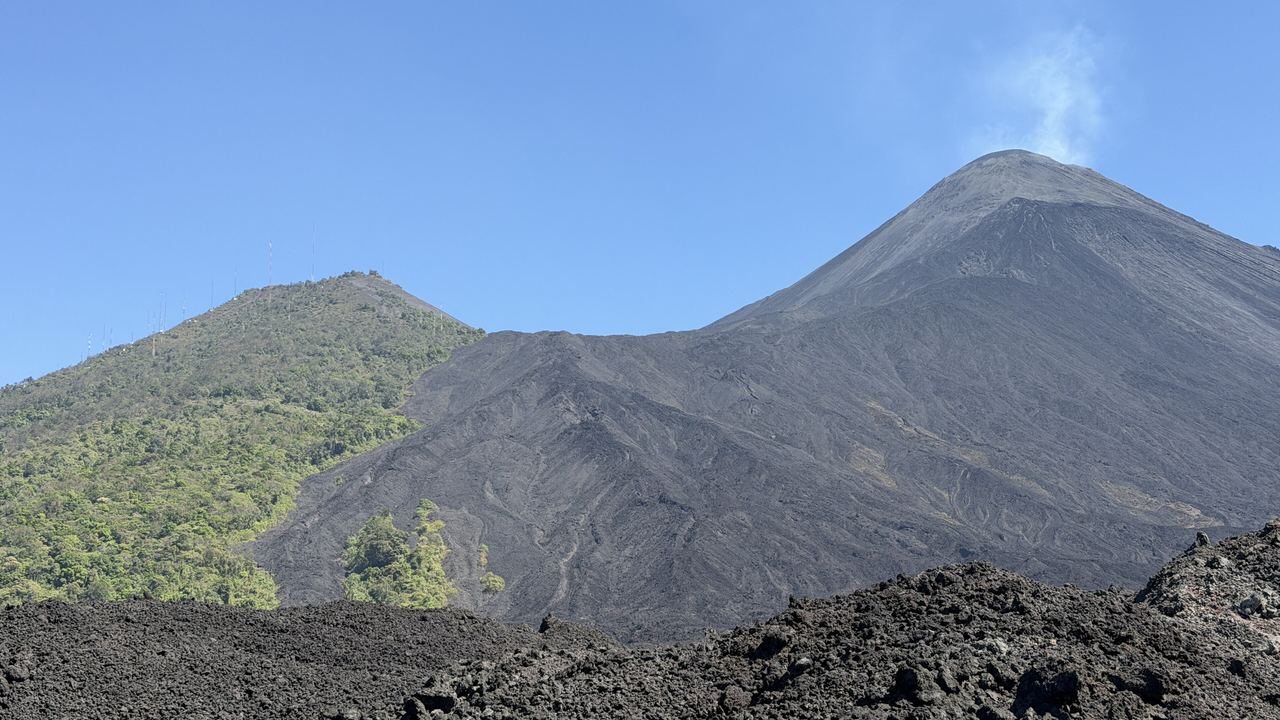
Pacaya Volcano Hike from Antigua
Five kilometres, about three hours on foot, and a viewpoint 255 metres below the summit that almost no listing mentions.
Two things about this walk are worth knowing before you pay for it, and neither is in most listings. You do not reach the top of the Pacaya. The trail ends at a viewpoint on the shoulder of the Cerro Grande at roughly 2,297 metres, and the summit crater is 2,552 metres, so about 255 metres of the mountain stays above you. And flowing lava is not part of what you are buying, whatever the photographs suggest. What you get instead is a field of black rock that has not finished cooling, cracks that breathe steam, a fuming cone overhead and a view across three other volcanoes to the Pacific plain. That is a good half day, honestly described.
This page is about that one day and nothing else: departure times, what the climb is like, what you pay at the gate in cash, whether to take the horse, and which of the twelve products is buying something genuinely different rather than the same walk with a better van. The Pacaya is also the right answer for anyone who has read about the overnight trek on the Acatenango and quietly decided it sounds like too much. It is not a consolation prize.
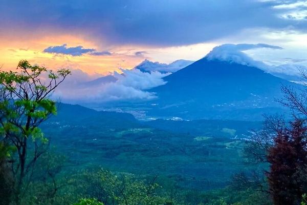
Pacaya at Sunset on Horseback: a Lava Chef, Dinner with Wine and S'mores
Three guides, one of them a cowboy with the horse, and a chef cooking at the base of the cone: dinner with wine at sunset and s'mores toasted on the lava.
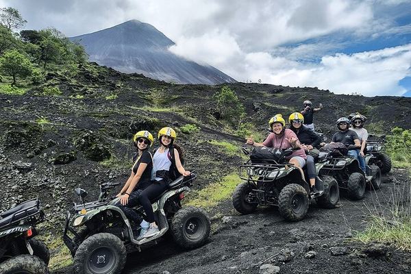
Pacaya by ATV: Private Plantation Lava Fields, Not the National Park
The quads ride the trails and a private plantation around the volcano rather than entering the national park, with snacks and entrance fees included.
Pacaya by Private Van: 7am to 2:30pm, with a Cold Drink at the Bottom
The van is yours alone, with a cooler on board, and the timings run from a 7:00 pick-up to a 14:30 return, with a drink included at the bottom.
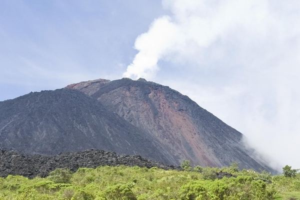
Pacaya Day Trip from Guatemala City, Crater Viewed Not Entered
The main crater is looked at from a plateau rather than entered, and the Calderas lagoon viewpoint has Agua, Fuego and Acatenango all in the same view.
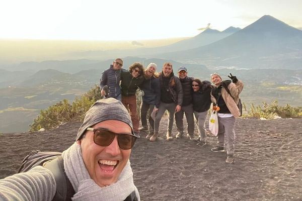
Pacaya from Antigua at 6am or 2pm: 1.5 Hours Up, Marshmallows on the Lava
Pick-up runs at 6:00 or 14:00 and is attempted once only, the park fee is paid separately, and the climb takes about an hour and a half to the petrified lava.
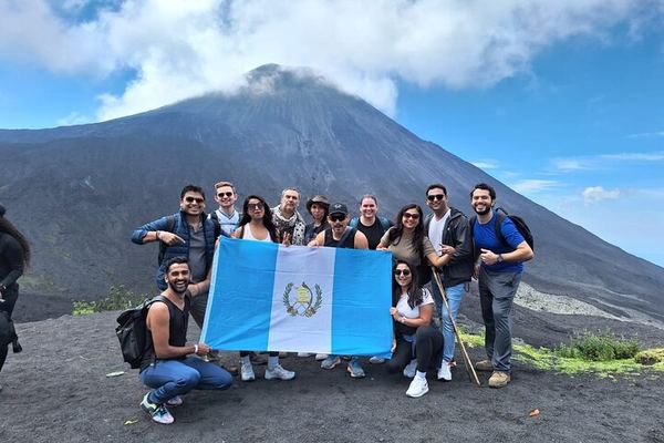
Pacaya from Antigua: the Plateau, the Steam Vents and Three Volcanoes in View
The crater is seen from the plateau rather than the rim, but the heat is close enough to roast marshmallows, with Agua, Fuego and Acatenango in view.
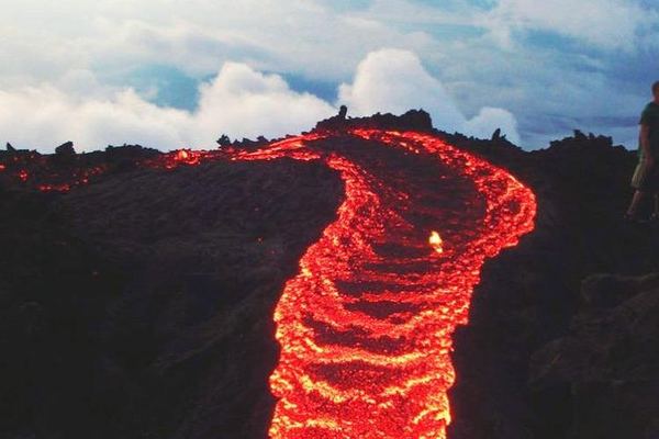
Pacaya from Guatemala City, Through Forest, Farmland and Lava
The trail runs 3.7 km through forest, farmland and lava, and the fumaroles at the top may be throwing ash or rock while you watch them from a distance.
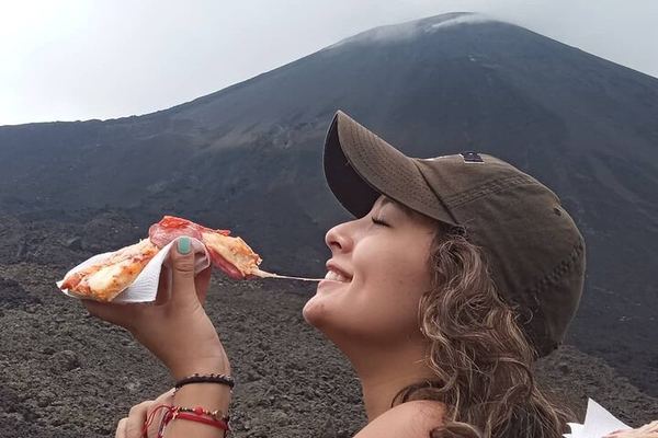
Pacaya Hike from Guatemala City with Pizza Baked Under Volcanic Rock
The chef bakes the pizza under volcanic rock when the mountain is hot enough for it, and over charcoal when it is not. The climb up takes 35 to 90 minutes.
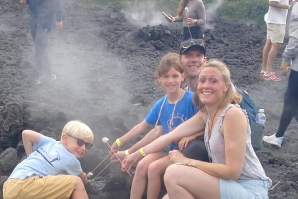
Pacaya, One of National Geographic's Ten Most Adventurous, from Antigua
National Geographic put this walk among the ten most adventurous in the world, and the view from the top reaches the Pacific coast and the capital's valley.
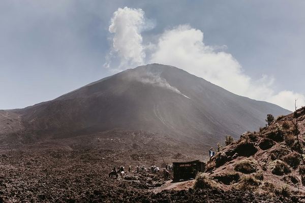
Pacaya Shared Hike from Guatemala City, Entrance Fee Apart
An hour and a half to San Vicente Pacaya, the same again to the top, an hour to come back down. The basic option leaves the volcano entrance fee to you.
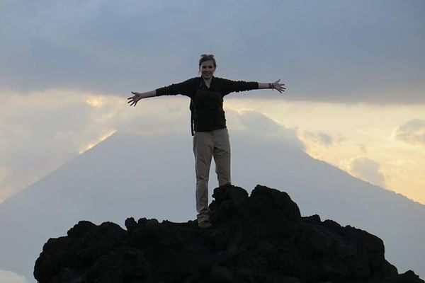
Pacaya to la Meseta with Old Town Outfitters: 8am to 4pm, Picnic on the Lava
The meet is at the outfitters' shop at 08:00, the climb takes ninety minutes to the shelf below the cone, and the picnic is eaten out on the lava field.
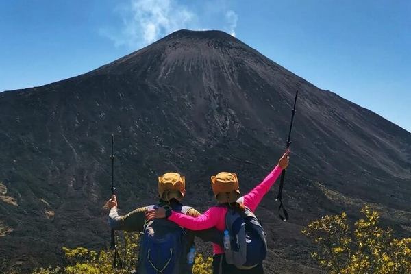
Pacaya via the Calderas Lagoon: 2.5 Hours Up, No Crater Access
The crater is off limits for safety, so the walk ends on the plateau, where the running lava and the steam vents are, past the lagoon of Calderas.
Ratings collected by Viator and Tripadvisor
The lava question, answered properly
It is the question everybody arrives with, and it is asked and answered badly across most of the pages that rank for this volcano. So, carefully.
The Pacaya has been in a vigorous eruptive period since 1961 and is one of the three volcanoes in Guatemala that is genuinely active. Being active means gas, ash, activity at the crater and, in bad years, evacuations. It does not mean a river of molten rock next to a walking trail, which is a rare and temporary arrangement anywhere it happens. On the Pacaya it did happen, for a stretch of years, and guides took different routes to whichever flow was moving that month. It is not a reliable part of the trip now and has not been for years. Whether there is any accessible flowing rock on the mountain in a given month is not something we can confirm, and we would rather say that than invent a date.
What we can confirm is how the day is being sold. One operator titles its page around guided hikes through active lava fields and promises active lava flows in the text. Two others, on the same mountain, state that there have been no flows since the last eruption. One of the tours listed on this page describes the lava in the past tense, in its own words, and has left the sentence up. Read the description, not the gallery.
What is there, reliably, is heat. In places the rock a foot below the surface is still warm from flows that have not finished cooling, which is why every operator here hands out marshmallows and a stick rather than lighting a fire. That heat is residual, held in the rock. It is not molten lava, and it is the detail nobody bothers to explain.
Until 2016, it was actually possible to see lava from up close during the hike. Different tour companies took different routes. During sunset hikes, as soon as it got a bit dark, the volcano could be seen throwing smoke and lava.
How far up you actually go
This is the other thing worth being precise about, because the imprecision is universal. Listings talk about reaching the summit, the top, the crater. The walk ends at a viewpoint on the flank of the Cerro Grande at around 2,297 metres. The MacKenney crater, the active vent, is at 2,552. Nobody walks into it and nobody is meant to: the gap is the safety margin, and it is the reason this is a moderate half-day rather than a mountaineering objective.
The practical version: about 5 kilometres there and back, two and a half to three hours of walking, on a wide track that starts in forest and farmland and turns steep and loose higher up. The ground is dirt and volcanic ash, and it is the descent people slip on rather than the climb.
What the Pacaya has actually done
The dates that decide what you will and will not see on the mountain.
The origins
1961
The current eruptive period begins
After a long quiet spell the Pacaya starts erupting vigorously and has essentially not stopped since. This is the eruption that is still running.
The growth
27 May 2010
The eruption that reached the capital
An evening eruption throws ash columns some 1,500 metres up and drops ash across Guatemala City and La Aurora international airport. A television reporter covering it is killed by falling debris. Tropical Storm Agatha arrives at the same time.
Around 2016
The period the photographs come from
Operators' own descriptions place the walkable, close-up lava of the marketing images in the years up to about here, and write about it in the past tense. The images have stayed up regardless.
Today
14 February 2021
The most recent eruptive episode starts
Ash and activity at the crater, with villagers near the volcano declining to evacuate. Reporting since then describes low level degassing from the MacKenney crater rather than flows.
April 2026
Under permanent measurement
INSIVUMEH reports sulphur dioxide measurement campaigns on the Pacaya. What the park allows in a given week follows what those readings say.
The shape of the day
Two departure slots exist and they are not equivalent. The six in the morning bus gets you onto the mountain before the cloud builds, which between May and October is the difference between a panorama and a white wall. The two in the afternoon bus is the one people book for the light, and it is the better photograph when the sky is already clear at the pickup. Most of the twelve listings run one or the other; a few run both.
| Stage | How long | What happens |
|---|---|---|
| Pickup | 06:00 or 14:00 | From your hotel or the operator's office. Several state they attempt the pickup once and then leave |
| Drive to the park | 1h to 1h45 | Via San Vicente Pacaya. From Guatemala City it is closer to two hours |
| The gate | 10 minutes | Q100 for foreign visitors, Q30 for Guatemalans, Q10 for students. One operator states cash is the only option |
| Ascent | 1h to 1h30 | Forest and farmland first, then steep on dirt and loose ash to the viewpoint near 2,297 m |
| On the lava field | 30 to 60 min | Cooled flows, steam from cracks, marshmallows toasted on the warm rock in the designated area |
| Descent | About 1 hour | The same loose gravel, downhill. This is where the rented stick pays for itself |
| Back in town | Around 16:00 | Total 5 to 8 hours door to door, of which 2.5 to 3 are walking |
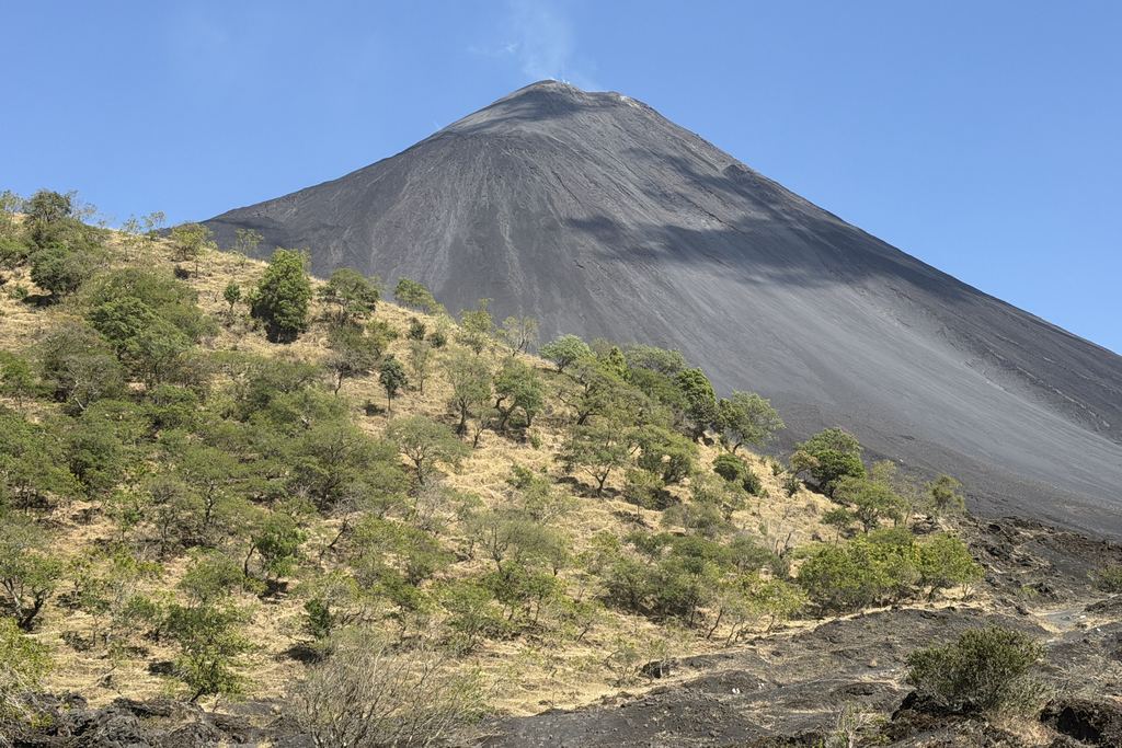
The stick, the horse and the hundred quetzales
Three small transactions happen on this mountain that are not in the price you compared online, and all three are in quetzales.
Entry is 100 quetzales for foreign visitors, with 30 for Guatemalans and 10 for students. If you see 50 quoted somewhere, that is an older price still circulating. Most listings exclude the fee and one states plainly that only cash is accepted. Bring it in local currency and in small notes: the booth at the trailhead is not a card terminal.
A wooden walking stick rents for 5 to 10 quetzales at the bottom, a euro or less. Take it. The descent is an hour on loose volcanic gravel and it is the part of the day people fall on.
And there are horses, offered along the lower trail by families from the villages at the base, at around 300 quetzales. You can arrange one in advance with some operators or negotiate on the spot. It is not a scam and it is not a novelty: it exists because the climb defeats a certain number of people every day, and it is how a group with mixed fitness all get to the viewpoint together.
What you can see from up there
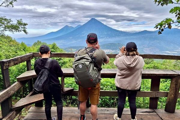
From the viewpoint, on a clear morning, the three volcanoes of the Antigua skyline line up to the north west: the Agua, the Fuego and the Acatenango. It is the fastest geography lesson in the country. To the south the land falls away to the Pacific coastal plain. Below and to the east sits the Calderas lagoon, a water-filled crater that the quad bike tours ride around.
If the Fuego is having an active day you will see that from here too, sixteen kilometres away and throwing ash. That is the daylight version of what people pay a hundred euros and a night at altitude for on the Acatenango, and it is part of why the Pacaya is a better introduction than its price suggests.

Twelve listings, and what actually separates them
The walk is the same walk. Everyone climbs the same national park trail with a guide certified by the Guatemalan authorities, in groups of up to fifteen. What the price difference buys is the vehicle, the group size, whether food and the gate fee are inside the number, and in three cases something genuinely different at the top.
| What it is | Price | How long | Leaves from |
|---|---|---|---|
| Shared minibus and a guide, nothing else | 21 to 26 EUR | 5 to 6 hours | Antigua |
| Shared day trip from the capital | 64 to 103 EUR | 6 to 8 hours | Guatemala City |
| Private vehicle, or lunch and gate fee included | 84 to 132 EUR | 5 to 8 hours | Antigua or Guatemala City |
| Quad bike around the base and the lagoon | 110 EUR | 8 hours | Antigua |
| Pizza cooked on the volcanic heat | 172 EUR | 6 hours | Guatemala City |
| Sunset on horseback with dinner cooked on the rock | 295 EUR | 6 hours | Antigua |
The best rated product here does not enter the park
This deserves its own section because it catches people. The quad bike tour is the highest rated Pacaya listing on this site, 4.9 from 296 ratings, and its own description states in capitals that it does not go into the San Vicente Pacaya National Park. It rides trails, villages, a private plantation and lava fields around the outside, with the Calderas lagoon as the set piece, and you can walk up onto a petrified flow as far as you feel like going. It is an excellent day out. It is not the park hike, and those 296 ratings are rating something else.
Two more conditions on that one: you need a valid driving licence, and you cannot book a passenger seat alone, somebody in your party has to book as a driver.
Questions people ask about the Pacaya
Can you see lava on the Pacaya volcano?
Not as a reliable part of the tour, and not for years. The volcano remains active and the crater degasses, but the close-up walkable flows in the marketing photographs belong to an earlier period, and operators' own descriptions say so in the past tense. Nobody can promise you molten rock on a given day and the ones who imply it in a page title are selling the photograph rather than the walk. What is dependable is the heat still held in the rock, which is enough to toast a marshmallow on.
Do you reach the summit of the Pacaya?
No. The trail ends at a viewpoint at roughly 2,297 metres on the shoulder of the Cerro Grande; the active MacKenney crater is at 2,552. That is about 255 metres of mountain you do not climb, and almost no listing says so. It is not a trick, it is the safety margin, but it does mean the phrase reaching the summit in a product description is doing some work.
How hard is the Pacaya hike?
Moderate, which is the wording every operator here uses. Roughly 5 kilometres there and back, two and a half to three hours of walking, on a wide track that starts gentle and turns steep and loose. Children do it. So do people who have not walked uphill in years, some of them on a horse for the middle section. It is not comparable to the Acatenango.
How much is the park entrance and can I pay by card?
100 quetzales for foreign visitors, 30 for Guatemalans and 10 for students. Most listings exclude it, and one states explicitly that cash only is accepted at the gate. Bring quetzales in small notes. This is the single most common surprise on the Pacaya and it is entirely avoidable.
Should I take a horse?
If you are unsure about ninety minutes of uphill, yes, and there is no shame in it: the horses are run by families from the villages at the base and a good number of visitors use them. Around 300 quetzales, arranged with your operator beforehand or on the trail. You will still walk the lava field at the end, because horses do not go onto it.
Morning or afternoon departure?
Morning for the view, afternoon for the light. Pickups are typically at six or at two. Cloud builds over the mountain through the day, especially from May to October, so the six o'clock bus is the safer choice for a panorama and the two o'clock is the better one for photographs when the sky is already clear as you leave.
Do you really toast marshmallows on the volcano?
Yes, and not over a fire and not over lava. In designated spots the rock still holds heat from flows that have not finished cooling, and it is enough to do the job. Most operators include the marshmallows. It sounds like a gimmick until you put your hand near the ground.
One note on the calendar, since it comes up. The Pacaya runs every day of the year and, unlike the overnight trek next door, the rainy season does not take the trip away from you. It moves it: from May to October, book the morning departure and accept that the afternoon may be cloud.
Data verified on. Times, fees, rentals and inclusions quoted from the 12 Pacaya listings on this site. Eruptive history and monitoring from INSIVUMEH and the published volcanological record.