
Five Years After the Lava Stopped: What a La Palma Volcano Visit Looks Like Now
The volcano turns five on Saturday. La Palma is still deciding, week by week, which houses people may sleep in: 1,179 properties cleared in Puerto Naos, a road built across the lava, and a bill that would close the new ground permanently.
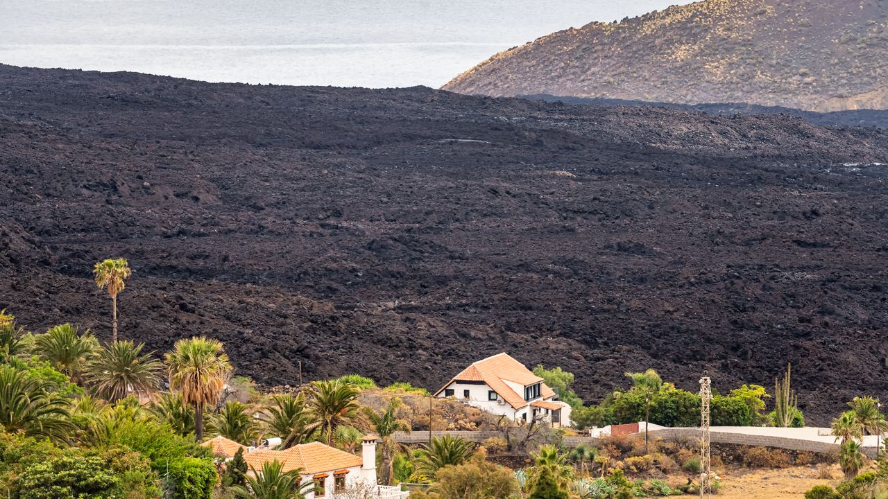
Anyone booking a La Palma volcano visit this autumn is booking to look at a mountain that turns five years old on Saturday. It was not on the map in the summer of 2021. At 15:11 local time on 19 September that year, on the record of Spain's national geographic institute, the ground opened in a wooded spot called Cabeza de Vaca, on the flank of Montaña Rajada, in the Las Manchas district of El Paso. Eighty-five days and eight hours later it stopped, and a cone roughly two hundred metres tall stood where a banana plantation had been.
Five is an awkward anniversary for a place like this. It is long enough that the international coverage has gone, and short enough that the island is still deciding, week by week, which houses people are allowed to sleep in. Both are true at the same time, and the second is the better story, because almost nobody outside Spain is reporting it.
So here is what the fifth anniversary actually marks, in dated decisions rather than adjectives: what the eruption did, how close you can get to the cone today, how many houses have been handed back, which roads exist, and what is about to become permanent by law.
What the La Palma volcano did, in eighty-five days and eight hours
The figures below come from the Canary Islands government's own end-of-eruption statement and from the national geographic institute, and they have not moved since, because they describe a finished event. 1,219 hectares buried. More than 200 million cubic metres of material. 2,988 buildings destroyed, around 7,000 people evacuated, and one death attributed to the eruption, a man who went back to clear ash from a roof. Most of the buried ground was banana plantation, and 73.8 kilometres of road went with it.
That last number is the one to sit with. An eruption of this size, in a valley holding tens of thousands of people, produced a single fatality. The reason is that the evacuation was ordered before the ground opened rather than after. It is the strongest argument for volcano monitoring that Europe has produced this century, and it is almost never made, because a disaster with no bodies does not hold the news. Set it beside the eruptions that changed the world and it is the outlier: comparable destruction, almost nobody killed.
The eruption also has two ending dates, and both are correct. The tremor stopped on the evening of 13 December 2021. The emergency committee then waited through ten days of silence before declaring the eruption over on 25 December. Sources that print only one of them are usually printing the second and calling it the first. On the same page they will often call the volcano Cumbre Vieja, which is the fourteen kilometre ridge it opened on and not the volcano at all. Its name is Tajogaite, and the island chose it by public vote.
Five years, in the decisions that were actually taken
Every entry is a dated act: an eruption, a vote, a road opening, a permit. The gaps between them are what the word recovery means here.
The origins
19 September 2021
The fissure opens at Cabeza de Vaca
15:11 local time, on the flank of Montaña Rajada in El Paso. Within days the flows are heading for the sea through the villages of the Aridane valley.
13 December 2021
The tremor stops
Eighty-five days and eight hours after it began, the longest eruption in the island's recorded history ends. Nobody is willing to say so yet.
25 December 2021
The state agrees it is over
After ten days of silence the emergency committee formally declares the eruption finished. This is the date most encyclopaedias print as the end.
The growth
1–30 June 2022
The island votes on a name
A public consultation run under the Revivir el Valle programme collects proposals. Tajogaite takes over 36% outright, and 59.3% of votes go to a proposal containing the name.
Summer 2022
An observation trail is authorised
The island council opens a guided route towards the cone from the Llano del Jable, walkable only with a permitted company. It has been relaxed in stages ever since.
9 February 2023
Tajogaite becomes the official name
The council makes it official in plenary session, unanimously. Some accounts date the same session to 9 February 2024; we follow the 2023 reading and flag the conflict.
25 May 2023
A road opens across the new lava
3.9 kilometres of asphalt laid on ground that was still hot, reconnecting the two halves of the valley after twenty months.
Today
December 2025
The proper road is started
Work begins on rebuilding the LP-2 between San Simón and Tajuya, on a budget of 24.1 million euros and a fourteen month programme.
March 2026
A bill to protect the lava field goes to consultation
The draft would put the cone, its fissure and the flow field inside the Cumbre Vieja Natural Park and create two reserves on the lava deltas. 309.5 hectares in total.
September 2026
Seven more homes are cleared
Four in Puerto Naos and three in La Bombilla, on gas readings. The cumulative totals reach 1,179 and 62.
How close a La Palma volcano visit gets you now, and why two listings disagree
This is the question people actually type, and the answer has changed several times since 2021. You cannot walk to the Tajogaite cone on your own. It sits inside a restricted area, and the only lawful way onto it is with a company holding a permit from the island council, which authorised an observation route in the summer of 2022. The walk starts at the Llano del Jable, at about 1,200 metres, on part of the old Cabeza de Vaca road, and most operators meet you lower down and drive you up.
What has not settled is where that route ends. Two products on sale on this site right now, both bought by people who went this summer, give different distances to the crater.
| Listing | What it says about the distance | Length and time | Price | Rating |
|---|---|---|---|---|
| Guided walk from El Paso | About 300 metres from the crater | 5 km, about 3 hours | 35 EUR | 4.8 from 2,449 |
| Guided walk from the Llano del Jable | A metre from the edge of one of its craters, and says so against its own older itinerary, which stopped about 400 metres short of a different one | 8 km, 3.5 to 4 hours | 40 EUR | 4.8 from 42 |
| The free viewpoints: Tajuya, Tacande, Llano del Jable, El Time | From a few hundred metres to several kilometres depending which | No walking | Free | Not applicable |
| The 2021 lava field itself | Closed. No route crosses it | — | — | — |
Both listings can be right. The cone has more than one crater, the authorised line has moved as the ground has been surveyed, and a description written eighteen months ago stays on sale unchanged until somebody edits it. The safe reading is that the shorter distance is the cautious one and the longer walk is the current one, and that if the distance is why you are going, it is a question to put to the operator by email rather than a number to trust from a listing. It is the same habit our guide to choosing a volcano tour recommends everywhere: the listing describes the day the copy was written, not the day you go.
What all of them share is the surface. Deep ash and lapilli, which walks like coarse wet sand and is why five kilometres takes three hours. No shade anywhere and no water. Groups are small, and the guides are firm about the marked line, which is not officiousness: in places the crust is thin over voids.
The cone
Two hundred metres of mountain, built in twelve weeks
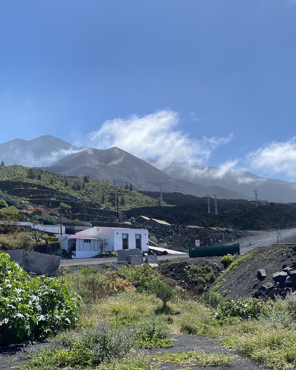
The cone stands roughly two hundred metres above the ground it grew on, which puts its summit near 1,120 metres. The inside of the flow field is still cooling after five years, and there are stretches of the guided routes where the ground is warm enough to feel through a boot sole.
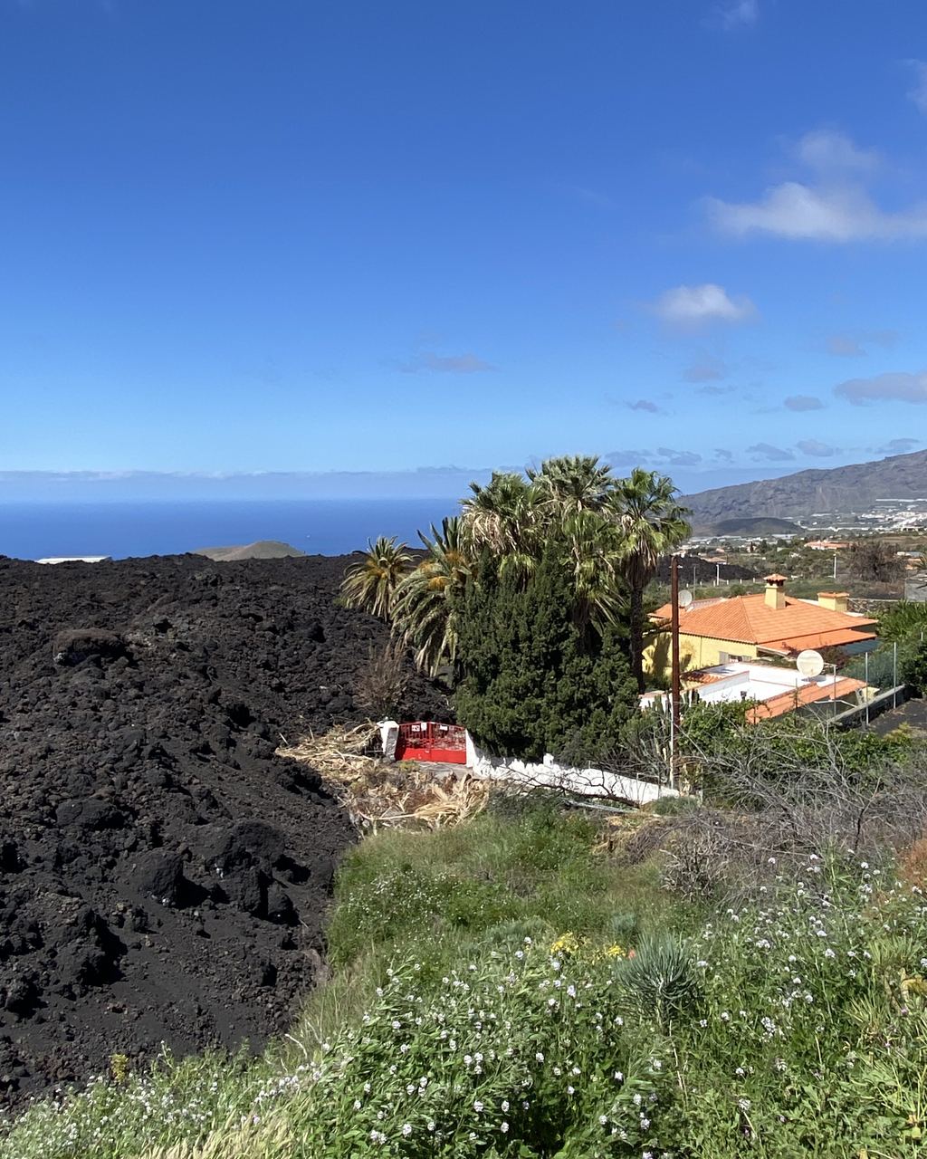
What you will not do is walk on the 2021 lava. The flows are closed, the two deltas the eruption pushed out into the Atlantic are closed, and the route runs on the ash slopes above them rather than across them. Anyone selling a walk over the new lava field is selling something that does not exist.
The anniversary of an eruption is easy to write. The anniversary of a recovery is a spreadsheet, and somebody updates it every few weeks.
The recovery is being counted house by house
The lava stopped in December 2021. The carbon dioxide did not, and this is the part of the story that the international coverage dropped somewhere around 2022.
Because the gas is heavier than air it collected in cellars, garages and low streets near the coast, and the two seaside villages of Puerto Naos and La Bombilla stayed evacuated long after the rock had gone cold. They are being handed back one building at a time, by an advisory body that meets, reads the sensor network installed after the eruption, and issues authorisations. Each authorisation is a named property, and the running total is published. Here is what the Canarian press has reported this year.
| Reported | Puerto Naos | La Bombilla | What that round added |
|---|---|---|---|
| July 2026 | 1,177 cleared, 1,020 with the safety protocol signed | 61 cleared, 52 signed | The social centre in La Bombilla, and two more businesses in Puerto Naos |
| September 2026 | 1,179 cleared, 1,021 signed | 62 cleared | Four more homes in Puerto Naos, three in La Bombilla |
Seven properties in two months looks like nothing until you see what it is: a colourless gas deciding, one address at a time, where roughly a thousand people may live. A report at the end of June 2026 described monitoring still running across Tajuya, Puerto Naos and La Bombilla, with something over a hundred passive trace detectors and a dozen continuous instruments, four of which were reading above the level that keeps a zone shut.
None of this is a visitor problem. The reopened parts of Puerto Naos are open precisely because they are measured, and a beach that looks entirely ordinary has a sensor on every other wall for the same reason. Carbon dioxide behaves differently from the gases people usually worry about on a volcano, which is one of the things our page on volcanic gas and what actually hurts people exists to explain. Worth knowing before you arrive: what decides where you can sleep on the west coast of this island is not rock, and has not been for five years.
The road the lava cut in two, and the one built on top of it
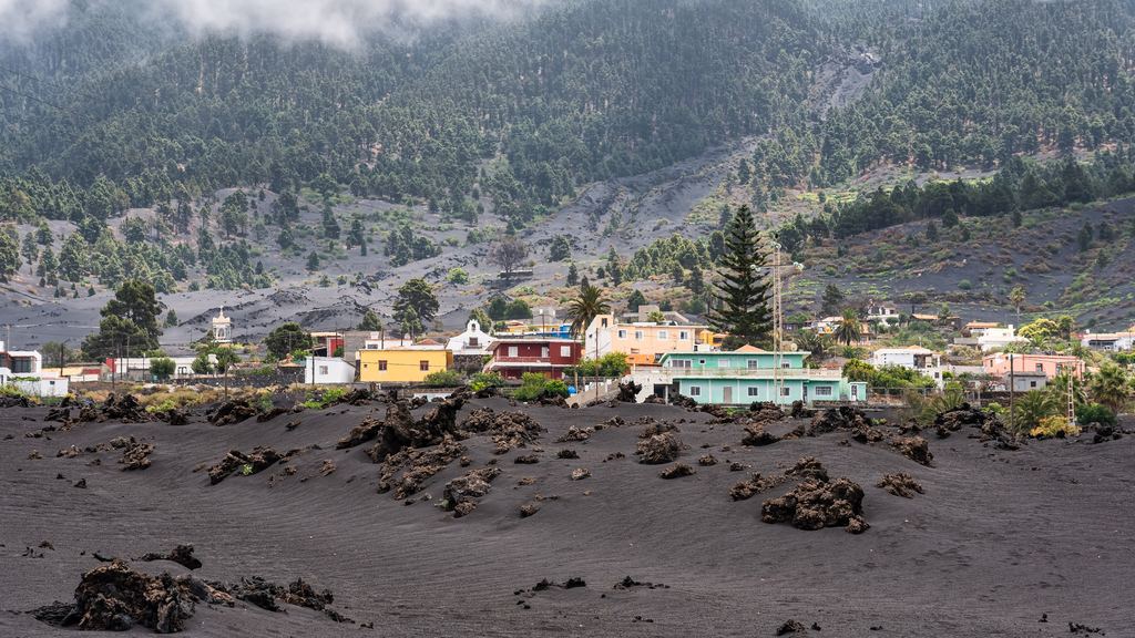
The flow field cut the Aridane valley in half. Two separate pieces of engineering have been answering that ever since, and they get confused with each other constantly.
The first is already open. A 3.9 kilometre road was cut straight across the new lava and put into service on 25 May 2023, built under an emergency regime on ground that was still hot, riddled with lava tubes and venting gas. The contractor claims it as the first time anywhere that hot bituminous asphalt has been laid over an active lava zone. Whatever the standing of that claim, driving over a two year old lava field on a road with a 70 km/h design speed is a strange thing to be able to do, and almost nobody outside the island knows it is possible.
The second is the one people are waiting for. The LP-2 between San Simón and Tajuya, the proper road rather than the emergency one, is being rebuilt on a budget of 24.1 million euros over a fourteen month programme. Work started in December 2025, and the regional public works department said in August 2026 that it expects to finish in the first quarter of 2027. So: a page telling you Las Manchas and Tajuya are cut off from each other was written before May 2023, and a page telling you the LP-2 is finished was written in hope.
A law is being written to keep the new lava closed
In March 2026 the Canary Islands government put a draft bill out for public consultation that would settle the status of the 2021 ground permanently. It would fold the Tajogaite cone, the surroundings of its eruptive fissure and the flow field into the existing Cumbre Vieja Natural Park, and create two new protected areas on the deltas the lava built in the sea: an integral nature reserve on the northern one, Costa del Perdido, and a special nature reserve on the southern one, Costa del Guirre. The three together come to 309.5 hectares.
An integral reserve is the strictest category Spanish conservation law has. If the bill passes in this shape, the answer to whether you can walk on the new lava stops being a matter of gas readings and temporary orders and becomes a matter of statute, and the answer is no. The draft was not uncontested. A local association objected in April 2026, calling it a serious historical mistake, largely over what it locks away from the people whose land it was. The bill had not become law when this article was written, and the consultation closed months ago, so it is worth checking rather than assuming.
For a place that lost nearly three thousand buildings, the argument five years on has moved past rebuilding. What is being decided now is which parts of the destruction become a park.
What we could not check today, and are not printing
This site publishes an eruptive state only when it has opened the source on the day of writing. Today it could not, so there is no alert level in this article.
La Palma sits under a four colour public alert, the semáforo volcánico, set by the regional emergency plan. It is a separate instrument from the aviation colour code, which describes ash for aircraft and says nothing about whether anyone may walk anywhere, and the two are quoted interchangeably until neither means anything. Our own audit of sixteen volcano observatories recorded the Spanish volcanology sources as the weakest of the set: one national subdomain serving an empty page, the Canarian institute's site in reconstruction. We could not open a current reading of the traffic light at source, so we are not reproducing one. The place to look is the Canary Islands government's own volcano portal, which is maintained continuously. This page is not. Our guide to where you can actually see lava explains why activity, access and visibility are three separate questions, and La Palma is now a clean example of the second one closing while the first stays quiet.
A page that opens is not a page that is current. And a page that will not open is not a reason to guess.
If you are going for the anniversary
The island is busier than it has been since before the eruption, and the figures are not ambiguous. La Palma took 113,564 visitors in the first quarter of 2026, up 17.45% on the same months of 2025. February on its own finished 2.1% above its equivalent in 2019, which is the comparison that matters, because 2019 was the last clean year before the pandemic and the eruption arrived on top of each other. Easter occupancy ran at 85.62%. Germany is still the largest single market by a wide margin.
What that means in practice: book the guided walk before you fly, not when you land. There are seven La Palma experiences on this site, and one of them carries nearly 2,500 reviews while the other six carry fewer than 350 between them. That is a market with more demand than supply, and no sign of new operators arriving to fix it.
Three things worth knowing that are not about the cone. The free viewpoints at Tajuya and El Time cost nothing and need no booking, and on half a day they beat a rushed walk. The Roque de los Muchachos, the island's other summit and one of the best observatory sites in the northern hemisphere, has had works on its access road, so check before committing an evening to it. And the world has two volcanic anniversaries this Saturday: Santorini holds its Ifaisteia, a fireworks re-enactment of an eruption staged on the caldera since 1991, on the same day. Greek press gives 19 September; the municipality had not published the programme when we last looked, so treat it as announced rather than confirmed.
If you came to this article hoping for molten rock, the honest answer is that La Palma has not had any since 2021, and our running list of where lava is visible has the four places that did, on readings dated last week. What La Palma has instead is a five year old mountain you can stand next to, a valley that is putting itself back together in public, and an argument about what to do with the ground in between. One last note on manners: the guided routes are run by local companies employing people from the valley, and whoever shows you round probably knows someone who lost a house. Ask before photographing a roof sticking out of the rock.
The questions people actually type
Can you visit the La Palma volcano in 2026?
Yes, with a guide. The Tajogaite cone is inside a restricted area and the only lawful access is on a route run by a company holding a permit from the island council. Walks start at the Llano del Jable at about 1,200 metres and run 5 to 8 kilometres, three to four hours, for 35 to 40 euros as read from the listings on this site on 15 September 2026. The viewpoints at Tajuya, Tacande, Llano del Jable and El Time are free and need no booking.
How close can you get to the crater?
It depends which product you book, and the two currently on sale here disagree. One says about 300 metres from the crater. The other says a metre from the edge of one of them, and notes that its own earlier itinerary stopped about 400 metres short of a different crater. The cone has more than one crater and the authorised line has been changed in stages since 2022, so both descriptions may be accurate to their own route. Ask the operator directly if the distance is the reason you are going.
Can you walk on the 2021 lava field?
No. The flow field and the two lava deltas are closed, and the guided routes run on the ash slopes above them rather than across them. A draft bill sent out for public consultation in March 2026 would make that permanent by folding the cone and the flow field into the Cumbre Vieja Natural Park and declaring two nature reserves on the deltas, 309.5 hectares in total. It had not become law when this was written.
Is there any lava to see on La Palma?
No molten lava. The eruption stopped on 13 December 2021 and was declared over on 25 December. What you walk on is black rock five years old, with interiors still cooling and ground warm enough to notice in places. Photographs of orange fountains were taken during the eruption. No operator on this site is claiming otherwise.
Is the volcano called Tajogaite or Cumbre Vieja?
Tajogaite. The name came out of a public consultation held between 1 and 30 June 2022 and was made official by the island council in plenary session on 9 February, unanimously. Accounts split between 2023 and 2024 for that session and we have not been able to settle it at source; we follow the 2023 reading. Cumbre Vieja is the fourteen kilometre ridge the vent opened on, carrying many other cones including the 1949 and 1971 eruptions.
Are Puerto Naos and La Bombilla open?
Partly, and the boundary moves. Both were evacuated for carbon dioxide that pooled in low ground after the eruption, and properties are being cleared for reoccupation one at a time on sensor readings. Canarian press reports put the cumulative totals at 1,179 properties cleared in Puerto Naos and 62 in La Bombilla in September 2026, against 1,177 and 61 in July. Reopened areas are open because they are measured.
Can you drive across the lava?
On one stretch, yes. A 3.9 kilometre road built under emergency conditions across the new flow field opened on 25 May 2023. Separately, the LP-2 between San Simón and Tajuya is being rebuilt on a 24.1 million euro budget, with completion announced for the first quarter of 2027.
What is the current alert level on La Palma?
We are not printing one. This site publishes an eruptive state only when it has opened the source on the day of writing, and the Spanish volcanology sources were not readable on 15 September 2026. The public alert is a four colour traffic light set by the regional emergency plan, and it is not the same instrument as the aviation colour code, which is about ash for aircraft. Check the Canary Islands government's volcano portal, which is updated continuously.
What is actually bookable on La Palma
Seven listings, from a lava tube at 27 euros to a day trip that starts on Tenerife. Prices and durations come from the operators' feeds and change without us.
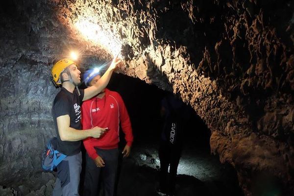
Caving the 1949 San Juan Lava Tube, 560 Metres of It
A guided walk through 560 metres of lava tube left by the 1949 San Juan eruption, lit by more than ten openings, some of them old fumaroles. Expert guide.
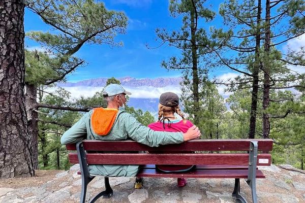
La Palma in a Day from Tenerife: the 2021 Lava and La Cumbrecita
Out on the 8:30 ferry from Los Cristianos and back on the 5 o'clock, with La Cumbrecita, the Tacande exclusion zone and the road built on the 2021 lava.
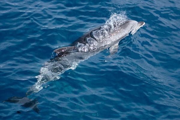
La Palma's Northwest Coast by Boat, Past Tijarafe and Puntagorda
From the sports dock at Tazacorte along the cliffs of Tijarafe and Puntagorda, then out into open water for whales, dolphins and turtles. Sunsets some days.
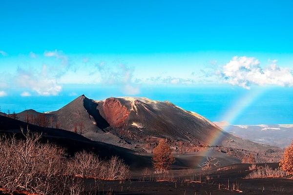
One Metre from the Crater Rim: the New La Palma Volcano on Foot
An 8 km walk over ash to the crater rim of the volcano that opened in 2021, closing to a metre from the edge. Departure at 08:45 from the office in El Paso.
Ratings collected by Viator and Tripadvisor
Guide, permit, or neither?
La Palma is one of the places where the honest answer is a permit held by somebody else. This page works through which volcanoes require a guide, which only recommend one, and where the rule people repeat does not exist in any act.
Data verified on. Canary Islands government end-of-eruption figures and volcano portal, Spain's IGN, Cabildo de La Palma, Canarian press reports of July–September 2026, and the products on this site. Editorial Policy


