
Mount Etna Is Erupting and You Still Will Not See Lava
Etna has been erupting since 6 August 2026, and the lava is in the Valle del Bove — on the eastern flank, behind an exclusion order, and out of sight of the cable car that most tours use. What the bulletins actually say, and what you will see if you go.

On 6 August 2026 Mount Etna began erupting, and within days the footage was everywhere: an orange river on a black mountain, ash drifting over Catania, an airport turning aircraft away. Two questions followed, in the search box and in the inbox of every operator in Sicily. Can I still go? And will I see that?
The first answer is yes, with conditions. The second is almost certainly no, and the reason is not danger or bad luck. It is geography. The lava is on the eastern flank, inside the Valle del Bove. The route that nearly every tour uses starts on the southern one.
This is the honest version, built on the bulletins of the Istituto Nazionale di Geofisica e Vulcanologia and on the ordinances the mountain's municipalities have actually signed, rather than on the phrase lava flow viewing that appeared in listings within a week of the first ash.
Where the lava actually is
The INGV weekly bulletin issued on 18 August, covering 10 to 16 August, describes the eruption in one line: explosive activity of variable intensity from the Voragine crater, brief explosive activity from the North-East Crater, and effusive activity in the Valle del Bove fed by several vents between 2,750 and 1,900 metres (9,020 and 6,230 feet).
The Valle del Bove is a collapse amphitheatre five kilometres wide on Etna's eastern side, floored in old lava and closed by walls up to a thousand metres high. It is where the volcano has sent most of its flank eruptions for centuries, and it is the reason those eruptions rarely threaten anyone: almost nobody lives in it, and almost nobody can walk into it.
The flows have behaved the way flows in that amphitheatre behave. On 12 August three vents were feeding at once, at 2,750, 2,090 and 1,900 metres, with the most advanced front near Rocca Capra at about 1,365 metres. On 13 August the middle vent died and the front pushed just past Rocca Capra to 1,340 metres — the lowest point the lava reached in this eruption. On 15 and 16 August fresh fronts overran the older ones and stalled around 1,395 metres, between Rocca delle Palombe and Rocca Musarra.
Then, on 17 August, a new vent opened at 2,350 metres and the eastern side of the Monte Rittmann cone collapsed, throwing up a sudden ash emission and feeding a short flow of about 500 metres that cooled quickly. By that afternoon the lava field was in regression.
Two lines in the bulletin matter more than the spectacle. The ground deformation networks show a general tendency to deflation across the whole volcanic edifice, and the chemistry of the lava samples indicates no significant recharge of deep magma. In plain terms: this eruption has been emptying a shallow store rather than being pushed by a new one from below.

Where the tours actually go
Ninety per cent of the people who say they have been up Etna have been up the southern flank. The road ends at the Rifugio Sapienza at 1,923 metres (6,309 feet), where the car parks, the ticket office and the souvenir stalls are. From there a cable car climbs to 2,500 metres (8,202 feet); above that, four-wheel-drive buses run to around 2,750 metres, and on some days to 2,920.
Above the cable car station you cannot go higher without an authorised volcanological guide. That is not a sales technique: it is the access regime of the Parco dell'Etna, and it is enforced. What a guide takes you to see, on a normal day, is the summit crater area — steaming vents, the Bocca Nuova rim, ground warm enough to feel through boots, and a view over the Valle del Bove from its western edge.
What is not on that itinerary is a flowing lava front. The active vents in this eruption sit inside the amphitheatre, hundreds of metres below and several kilometres east of where the 4×4 stops. Between the two lies terrain that is closed. The listings that promise lava flow viewing from the southern flank are selling the mountain, not the eruption.
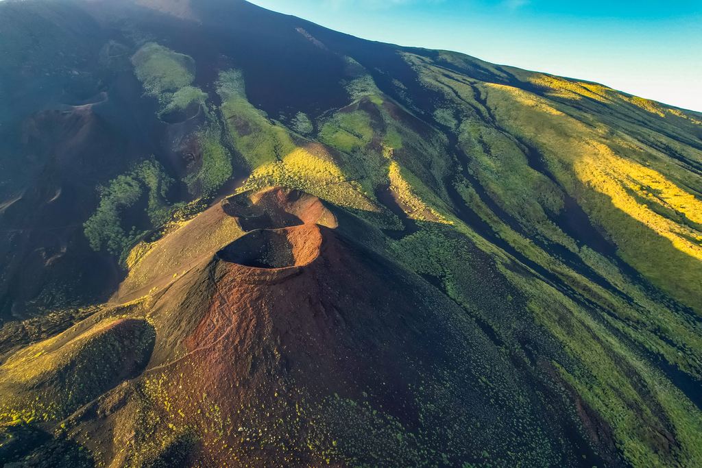
The two Etnas
The southern flank is a different mountain
The Silvestri craters, a few minutes' walk from the Rifugio Sapienza car park, are the postcard of Etna's south: two neat 1892 cones you can walk into, at 1,900 metres, reachable in trainers.
They are also a useful measure of the distance involved. They sit at almost exactly the altitude of the vent that has been feeding this eruption, and about eight kilometres away from it, on the other side of the summit.
This is why the answer to is Etna open? is usually yes even during an eruption. The mountain has room for both: an emergency in one valley and a coach party in another.
So what do you see, if you go this week?
More than the disappointed version of this article would suggest, and it is worth being precise about it.
From the summit area you look down into the amphitheatre. The western rim of the Valle del Bove is part of the standard guided route, and on a clear day the fresh lava field is in front of you from above: a dark tongue several kilometres long, still steaming where it has not cooled, with the ochre scar of the Monte Rittmann collapse at its head. It is not molten rock at arm's length. It is the shape of an eruption, seen whole, which the photographs never show.
The ground itself has changed. Fresh ash from the Voragine has been falling on the southern flank for two weeks, in modest loads of fine particles, and it is on everything above the tree line. Walking on ash that fell this month is a different surface from the compacted grey scoria of a normal August.
And there is the night. When the vents are effusing strongly, the glow is visible from the eastern towns — Zafferana Etnea, Milo, Fornazzo — without going anywhere near the closed ground. This is how most of the good amateur photographs of this eruption were taken: from a road, with a tripod, at a legal distance. It is also the one thing that no operator can promise, because it depends on what the vent is doing that evening.
What none of this is, is a guarantee. On 18 August the tremor collapsed and the explosive activity stopped; the effusion continued at one vent. By the time you land, either could have resumed or ended.

What the ordinances actually say
Access on Etna is not governed by the volcano observatory. INGV monitors and publishes; the closures are signed by the mayors of the municipalities the mountain sits in, one ordinance at a time, and the Parco dell'Etna republishes them. That is why there is never a single answer to whether Etna is open: there are ten answers, one per comune, and they are not synchronised.
Four were signed in the first half of August 2026.
| Municipality | Ordinance | Date |
|---|---|---|
| Belpasso | no. 135 | 10 August 2026 |
| Milo | no. 41 | 13 August 2026 |
| Sant'Alfio | — | 13 August 2026 |
| Bronte | — | 14 August 2026 |
The one that matters for anyone hoping to walk up to the flow is Milo's. It closed the Mareneve road between Fornazzo and the Rifugio Citelli, which is the natural approach to the northern rim of the Valle del Bove, and it set «un divieto assoluto di avvicinarsi a meno di 200 metri dal fronte lavico»: an absolute prohibition on approaching within 200 metres of the lava front. It runs until further notice, and the prefecture has had drones checking it, because people were walking in anyway.
Two hundred metres is further than it sounds. At that distance an active front is a bright line at the bottom of a slope, not the wall of moving rock in the photographs. Those pictures are taken with long lenses, by people with permits, or by drones.
The red alert you read about was for aeroplanes
In the same ten days the phrase red alert appeared in headlines several times, then downgraded to orange. Both refer to the aviation colour code, the scale volcano observatories use to tell air traffic control how much ash is going into the sky. Red means an eruption with a significant ash plume, or one likely within hours. It says nothing about whether the mountain is dangerous to stand on, and nothing about whether the roads are open.
The scale that governs people on the ground is civil protection's, it is run regionally, and it moves far more slowly and far less often. Confusing the two produces both halves of the wrong picture: travellers cancelling a trip because of a code meant for pilots, and travellers walking towards a flow front because the civil protection level had not changed.
On 18 August the aviation code came down from red to orange, the explosive activity at the Voragine stopped around midnight UTC, and the volcanic tremor fell from high to low values in about half an hour. Catania airport went back to normal operations. The vent at 1,900 metres was still effusing.
Thirteen days, from the first ash to the aviation code coming down
Compiled from INGV bulletins and communications. Times in UTC, altitudes above sea level.
The origins
5 August
First ash from the Voragine
Discontinuous ash emission begins at 17:10 from the Voragine, one of Etna's four summit craters.
6 August
The eruption INGV dates
An impulsive explosive event at 00:51 is followed by Strombolian activity. This is the date the observatory gives as the start.
The growth
8 August
The effusion moves into the Valle del Bove
A vent opens at 2,360 metres and feeds flows onto the floor of the amphitheatre.
10 August
Ash to the south, and no arrivals at Catania
The plume drifts over the southern flank and the airport suspends incoming flights.
12 August
Three vents at once
Lava leaves vents at 2,750, 2,090 and 1,900 metres; the leading front is near Rocca Capra at about 1,365 metres.
13 August
The lowest front, and the first exclusion order
The 2,090 m vent dies; the front pushes past Rocca Capra to 1,340 metres. Milo signs ordinance no. 41.
14 August
A pit crater at 3,000 metres
A collapse pit forms high on the mountain and degasses intermittently for a short period.
16 August
Fronts stall at 1,395 metres
New flows overrun the older ones and stop between Rocca delle Palombe and Rocca Musarra.
Today
17 August
Monte Rittmann loses a flank
A vent opens at 2,350 metres and the eastern side of the cone collapses, throwing up a sudden ash cloud. The flow it feeds runs 500 metres and cools.
18 August
Tremor collapses, code goes to orange
Explosive activity ends around midnight; tremor falls from high to low in half an hour; the aviation colour code is lowered and the airport returns to normal.
The month you go still matters more than the eruption
An eruption is the loud variable and the one nobody can plan around. The quiet one decides far more trips: Etna runs a summer season and a winter season at the same time, at different heights, and the summit is the part with the short window.
| 1 | 2 | 3 | 4 | 5 | 6 | 7 | 8 | 9 | 10 | 11 | 12 |
How to check it yourself, the day before you fly
Everything above will be out of date at some point, possibly by the time you read it. The useful skill is not knowing this eruption, it is knowing where to look, and on Etna the sources are unusually good.
INGV Osservatorio Etneo publishes a multidisciplinary weekly bulletin, the one used here is Rep. no. 34/2026, plus communications during activity, and its material is released under a Creative Commons licence. The bulletins are technical and in Italian, but the first page is a seven-point summary that anyone can read.
The Parco dell'Etna keeps the mayors' ordinances in one place. If a road or a path is closed, it is there, with the municipality and the date. It is the only way to know what is shut, because no one else aggregates ten town halls.
The operator is the third source, for the question the other two cannot answer: what happens to your booking if the route closes on the morning. Ask before paying, not after. Our guide to what happens if the volcano erupts covers the refund and insurance side, including the rule that catches people out: do not cancel your own flight voluntarily, because passenger rights usually depend on the airline cancelling it.
For the wider question of which volcanoes let you see molten rock at all, and how few of them there are, there is where you can actually see lava, and how to check whether a volcano is erupting for reading an alert level without mistaking a pilots' code for a public safety one.
What is running on Etna right now
Summit tours from the southern flank, which is the part of the mountain the eruption has not closed. Prices and durations come from the operators' feeds.
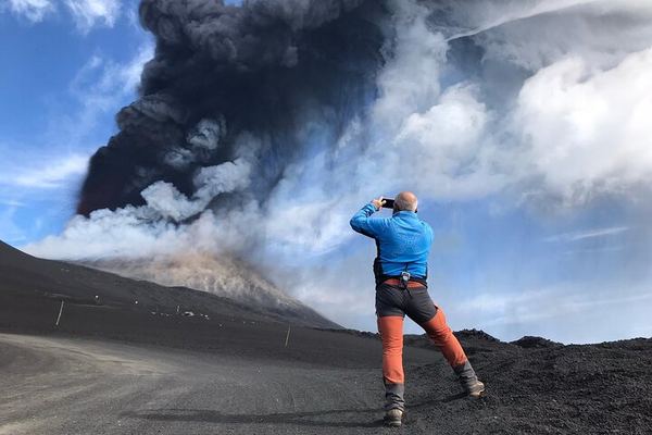
Etna 3,000 m with Alpine Guides: Barbagallo, Torre del Filosofo, 3 Hours on Foot
The cable car and jeep ticket is paid in cash on site, not included. Four hours of walking to Barbagallo, the 2002 vent and Torre del Filosofo.
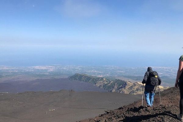
Etna Craters at 3,000 m: Where the 2021 Lava Buried the 1971 Cone
The walk starts where the 1971 explosive cone stood until the 2021 flows buried it. Volcanologist guides, meeting at 10:30 by the cable car.
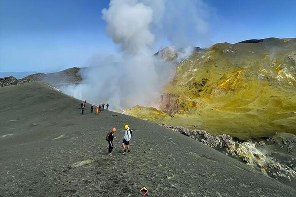
Etna North Summit at 3,380 m: 4x4 to 2,960 and the Four Active Craters
The north side goes highest: 9.5 km of track to 2,960 m, then five hours on foot to the four summit craters. Which one you reach is decided that morning.
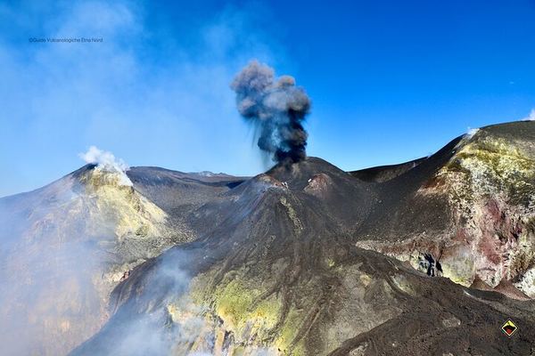
Etna North Summit on Foot Both Ways: 1,580 m of Descent, Experts Only
The climb is 500 metres, the walk down is 1,580 over 7 km, and the operator warns it is the harder half. The bus back from 2,850 m costs extra.
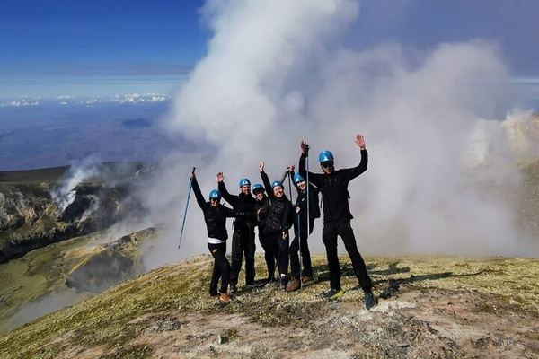
Etna North to 3,320 m with Ashàra: Sulphur Colours and the Crater Rims
A 4x4 to Piano delle Concazze, then two hours up to the rim at 3,320 m, past gas vents, volcanic bombs and ground coloured by sublimated sulphur.
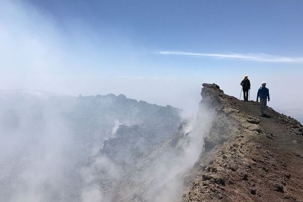
Etna South Summit 3,340 m: Cable Car, 4x4, and Two Hours on Foot
The cable car and a 4x4 take you to 2,850 m, so only two hours are walked to the top, past Bocca Nuova and the South-East Crater. Lunch at 3,000 m.
Ratings collected by Viator and Tripadvisor
Questions people are asking this month
Is it safe to visit Etna during this eruption?
The southern access route has stayed open throughout, and the activity is confined to the eastern amphitheatre. The risk is not the eruption but the temptation: the injuries on Etna come from people leaving the marked ground, not from tours. Note also that INGV's own scenario section states plainly that on a volcano in this state the hazard level is never zero, and that phenomena can evolve without warning.
Will I see lava on a summit tour?
Almost certainly not. The vents feeding this eruption are inside the Valle del Bove, on the other side of the summit from the cable car, and the ground below the flow fronts is inside a 200-metre exclusion order. What a summit tour shows is the crater area, and from the western rim, the new lava field from above.
Can I hike to the lava flow with a guide?
Not to the front. Milo's ordinance forbids approaching within 200 metres of it and closed the Mareneve road between Fornazzo and the Rifugio Citelli, which is the natural way in from the north-east. Guided walks on the Valle del Bove rim can run when the municipality that owns that ground allows them, and that changes week by week.
Was Catania airport closed?
It suspended arrivals on 10 August because of ash and worked at reduced capacity afterwards, returning to normal operations on 18 August when the aviation colour code came down. Ash disrupts flights, not roads: the mountain stayed reachable by car throughout.
Where can I see the glow at night?
When the vents are effusing strongly it is visible from the eastern towns below the Valle del Bove, from public roads and well outside any closure. It depends entirely on what the vent is doing that evening, which is why no operator sells it as a certainty.
How long will this eruption last?
Nobody can say, and anyone who does is guessing. What the 18 August bulletin does say is that the edifice is deflating and that the lava chemistry shows no significant recharge of deep magma, which is consistent with an eruption emptying a shallow reservoir rather than one being fed from below. That is a description of the current state, not a forecast.
Data verified on. INGV Osservatorio Etneo, weekly bulletin Rep. no. 34/2026 (10–16 August, issued 18 August 2026), its communication of 18 August, and the mayors' ordinances published by the Parco dell'Etna. Editorial Policy


