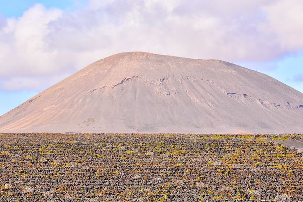
The 2,900-Metre Rule on Etna Does Not Exist. Here Is What the Ordinances Actually Say
Every operator and half the blogs on the internet repeat the same figure: above 2,900 metres on Etna you need a guide. It appears in no ordinance. What the acts regulate is a zone and an operational phase, and the number that matters is 2,500.

Do you need a guide on Etna? Ask in English and you will get a number back. Two thousand nine hundred metres. Above it a guide is compulsory, below it you are free, and the figure carries the reassuring precision of something copied out of a document.
We went looking for the document.
What exists is a regional framework for volcanic alerting written in 2013, two zones that were redrawn and renamed in August 2025, a stack of mayoral ordinances signed one town hall at a time, and a professional register created by a law from 1989. Between them they do make a guide compulsory, on some ground, some of the time. None of them does it at 2,900 metres, and none of them does it by altitude at all.
Where 2,900 metres actually comes from
There is a real place at 2,920 metres on Etna's southern flank. It is called Torre del Filosofo, a ruined refuge that the lava has buried and partly re-buried over the years. Every guide on the mountain knows the name and it sits on every map.
It is also, near enough, where the four-wheel-drive buses stop. The cable car from the Rifugio Sapienza ends at 2,500 metres, the tracked vehicles carry on up the jeep road above it, and depending on the ground and the day they turn round somewhere between 2,750 and 2,920 metres. That is where the transport ends, and where a visitor who wants to keep going has to walk, with someone who holds a licence.
Round 2,920 down to the nearest hundred and you have 2,900. A logistical fact about where a bus turns round became, somewhere in the retelling, a legal threshold. It is an easy mistake to make and an easier one to repeat, because from the passenger seat the two sentences look identical: this is as far as we go, and above this you need a guide. Both are true on the day. Only one of them is written down, and it is not the one with the number in it.
Once you start counting the altitudes in circulation, the problem stops looking like a single error and starts looking like a habit.
| Altitude | Where you meet it | What it actually is |
|---|---|---|
| 2,500 m | Ordinance texts and civil protection pages | The lower boundary of the Zona Sommitale. This is the figure the acts work with |
| 2,600–2,800 m | Commercial guide pages, as a range | A range, not a threshold. No text we could reach states it |
| 2,750 m | Tour listings | Roughly where the 4x4 buses stop on a normal day. An operational altitude |
| 2,850 m | Reporting during the August 2026 eruption | Named in accounts of specific closures. We could not tie it to a published text |
| 2,900 m | Blogs, operator FAQs and aggregators, as the limit | Nothing. It appears in no ordinance we could find. It is 2,920 rounded down |
| 2,920 m | Hiking sites, as the free limit | Torre del Filosofo. A ruined refuge and a landmark, not a boundary in any act |
| 2,980 / 3,100 / 3,200 m | Coverage of the August 2025 closures | Three effusive vents, closed individually. Vents, not thresholds |
What the acts regulate is a zone, and a phase
Access to the high part of Etna runs on a framework the Prefecture of Catania issued in 2013, under a title that describes exactly what it does: Procedure di allertamento per rischio vulcanico e modalità di fruizione per la zona sommitale del vulcano Etna. Alerting procedures for volcanic risk, and terms of use for the summit zone of Mount Etna. Two things in one document, and the pairing is the point. How the mountain is watched and what you are allowed to do on it are written together, because the first governs the second.
The geography it works on is not a contour line. It is two areas. The Zona Sommitale is the summit zone, and its lower edge sits at around 2,500 metres. Below and around it lies the Zona a Pericolosità Permanente, the zone of permanent hazard, which until recently everyone called the zona gialla, the yellow zone.
The rename was not cosmetic. On 21 August 2025 Sicily's regional civil protection department circulated new perimeters for both zones, drawn by the Istituto Nazionale di Geofisica e Vulcanologia, and both came out larger than before. Anyone working from a map, a blog post or an operator page that predates that date is describing ground that has since moved. The yellow zone, as a name and as a shape, is gone.
The acts do not ask how high you are. They ask which zone you are standing in, and what phase the volcano is in that morning.
Do you need a guide on Etna? Only in one zone, and only sometimes
When the summit zone is open under guide, the conditions attached to it are procedural rather than altimetric. From the ordinance texts and the fruition procedures: the guide checks the weather and the state of the volcano before setting out, briefs the group on the risks in a language the group understands, and collects from each walker a signed declaration of fitness covering physical and psychological condition, the absence of cardiac and respiratory illness, and acknowledgement of the dangers the excursion involves. Helmets are compulsory. Groups are spaced at fifteen-minute intervals, so that too many people are not standing on the same ground at the same moment.
Two further limits, a maximum number of walkers per guide and a ceiling on people admitted per day, appear in our reading of the ordinances dated 18 August 2026. We could not re-open those texts today to confirm the figures, so we are not printing them. That they exist is the useful part. The regime is built to control how many people are where, and when, which is a spacing problem rather than a height problem.
Notice also what the helmet is for. The hazard the whole procedure is designed around is a fragment arriving from above, thrown by an explosion, onto open ground where there is nothing to shelter behind.


Below the line
What you can do on your own
Under ordinary conditions, walking on Etna without a guide is legal, normal and popular. The old flank craters, the lava fields, the tracks through the pine woods on the northern side and the Silvestri cones a few minutes from the southern car park are all open ground.
The restriction bites in one place only: the summit zone, and the hazard zone when the volcano's operational phase closes it. Everything below that is a mountain you can walk on like any other, which is why guided walks that stay below the summit exist as a separate product from the summit trip, at a different price, with a different purpose.
Three scales, and only one of them decides whether you can walk up
Etna is watched on more than one instrument panel, and the numbers and colours they produce get folded together in English coverage until they mean very little.
The first is the operational phase, run by Sicily's regional civil protection department: base level, attention, pre-alarm, alarm. This is the one that closes ground. On the department's own account, pre-alarm shuts the Zona a Pericolosità Permanente and the move to alarm extends the ban to the whole Zona Sommitale. A second reading of the same procedures, which we could not settle against a third source, has pre-alarm already suspending activity under way in both zones at once. The difference matters if you are on the mountain when the phase changes, and it is a good argument for taking the instruction from the person at the gate rather than from an article.
The second is ETNAS, a monitoring system with three states, F0, F1 and F2, describing how likely a lava fountain is in the near term. F1 and F2 trigger interdiction of the summit areas, with checkpoints and gates on the main and secondary approach routes. It is the fastest moving of the three, because a fountain gives less notice than a flank eruption.
The third is the aviation colour code, and it is the one that reaches you through the news. It describes ash in the sky, for aircraft. It says nothing about the ground. We have written about that confusion before and will not repeat it here, beyond noting that a red code and a closed footpath are unrelated events which happen to share a colour vocabulary.
| Scale | Who runs it | What it describes | What it does to your access |
|---|---|---|---|
| Operational phase: base, attention, pre-alarm, alarm | Regional civil protection department, Sicily | How the civil protection system is mobilised | Pre-alarm closes the Zona a Pericolosità Permanente; alarm extends the closure to the whole summit zone |
| ETNAS: F0, F1, F2 | INGV monitoring, read by civil protection | Probability of an imminent lava fountain | F1 and F2 trigger interdiction of the summit areas, with checkpoints and gates |
| Aviation colour code: green, yellow, orange, red | INGV Osservatorio Etneo, for air traffic | Ash in the atmosphere, for aircraft | Nothing. It is not about people on the ground |

Ten town halls, and none of them speaks for the mountain
The framework sets the zones. What actually closes a road or a path is an ordinance signed by a mayor, and Etna does not have a mayor. It has a ring of municipalities, each owning a slice of the volcano, each signing its own paper on its own timetable. The Parco dell'Etna collects them in one place, which is the only reason it is possible to see them side by side at all.
So there is no single answer to whether Etna is open, and there never has been. There are as many answers as there are comuni, they are not synchronised, and a municipality that has not updated its ordinance leaves its ground under whatever the last one said. During the eruption in the first half of August 2026, four different town halls signed four different orders inside five days, each binding only its own territory.
This is also why the altitude story survives so well. A single number travels. Ten ordinances with different dates, different perimeters and different exceptions do not travel at all, so the number goes out into the world and the ordinances stay where they were filed.
The Etna guide rule binds the guide, not you
Here is the part that explains where the confusion started.
Alpine and volcanological guiding in Sicily is a regulated profession. It rests on national Law 6 of 2 January 1989, which established the profession of mountain guide, and on Sicilian regional Law 28 of 6 April 1996, which created the Regional College of Alpine and Volcanological Guides of Sicily. Professionally accompanying people on a volcano is reserved to guides on that register, and Article 18 of the 1989 law provides a financial penalty for practising without the qualification.
Read it slowly and notice who is on the hook. The law regulates who may guide. It does not say that a visitor must be guided. The register is a rule about a profession, in the same family as the rules deciding who may call themselves an architect. The obligation that falls on you, when one does, comes from somewhere else entirely: a mayor's ordinance, closing specific ground, for as long as it says so.
The two get merged constantly, and the merged version has its own logic. Guides are exempt from limits that bind everyone else, because a guide is qualified to be up there. So the guide goes where the individual cannot, and from outside that looks like a rule saying you need a guide above a certain height. What it says is that above a certain zone, in a certain phase, the ground is closed to people who are not qualified to be on it.
It is the same shape of misunderstanding as the one on Mount Batur in Bali, where a rule reserving guiding work to local residents circulates in English as a law obliging tourists to hire a guide. Our page on where you need a guide, a permit, or both keeps the two apart deliberately, destination by destination.
What this article deliberately does not tell you
It does not tell you what phase Etna is in today, whether the summit zone is open this week, or where the current closure line runs.
That is not an oversight. Those three facts change faster than any article can hold them, and this one was written without being able to open the observatory and the department's own pages directly. Publishing a phase we could not read at source would turn this page into precisely the thing it is arguing against: a plausible number, well formatted, quietly out of date. This field already has plenty of those. One institutional safety page went on serving the sentence there is no eruption in progress for eleven months.
So the structural half is here, because it holds for months at a time, and the current half is one click away, maintained by the people who measure it. Sicily's regional civil protection department publishes the operational phase and the zone perimeters. The Parco dell'Etna publishes the mayors' ordinances. Between them you can answer, in about two minutes, the question this article cannot: not how high can I go, but which zone is closed today, and who closed it. Our guide to checking whether a volcano is erupting covers reading an alert level without mistaking one scale for another.
And if you take one thing from all of this, make it the substitution. Stop asking how high you may go on Etna. Start asking which zone your route enters, and what phase the volcano is in on the morning you walk it. Those are the two questions the acts are written to answer, and the only ones an operator can answer honestly.
Three things to check, in this order
None of them is an altitude.
Which zone your route enters
The summit zone and the hazard zone are the only two lines that carry a legal consequence. Everything else is a landmark.
How hard the route is
Open and manageable are different questions. The difficulty index scores 39 volcano routes on a published formula.
What the volcano is doing that week
How to read an operational phase, and how to tell it apart from the code meant for pilots.
Summit tours on Etna
Trips that go above the cable car, where an authorised guide is the access condition. Prices and durations come from the operators' feeds.
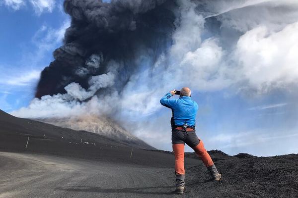
Etna 3,000 m with Alpine Guides: Barbagallo, Torre del Filosofo, 3 Hours on Foot
The cable car and jeep ticket is paid in cash on site, not included. Four hours of walking to Barbagallo, the 2002 vent and Torre del Filosofo.
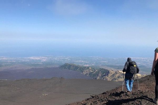
Etna Craters at 3,000 m: Where the 2021 Lava Buried the 1971 Cone
The walk starts where the 1971 explosive cone stood until the 2021 flows buried it. Volcanologist guides, meeting at 10:30 by the cable car.
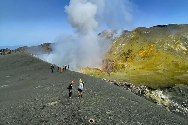
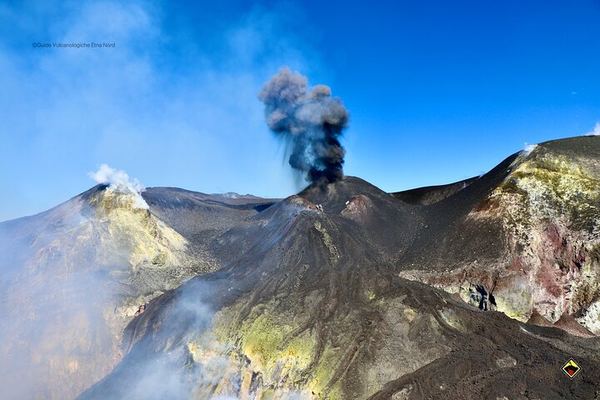
Etna North Summit at 3,380 m: 4x4 to 2,960 and the Four Active Craters
The north side goes highest: 9.5 km of track to 2,960 m, then five hours on foot to the four summit craters. Which one you reach is decided that morning.
Etna North Summit on Foot Both Ways: 1,580 m of Descent, Experts Only
The climb is 500 metres, the walk down is 1,580 over 7 km, and the operator warns it is the harder half. The bus back from 2,850 m costs extra.
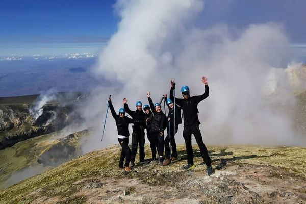
Etna North to 3,320 m with Ashàra: Sulphur Colours and the Crater Rims
A 4x4 to Piano delle Concazze, then two hours up to the rim at 3,320 m, past gas vents, volcanic bombs and ground coloured by sublimated sulphur.
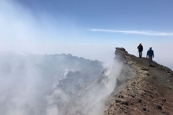
Etna South Summit 3,340 m: Cable Car, 4x4, and Two Hours on Foot
The cable car and a 4x4 take you to 2,850 m, so only two hours are walked to the top, past Bocca Nuova and the South-East Crater. Lunch at 3,000 m.
Ratings collected by Viator and Tripadvisor
The questions behind the number
Do you need a guide to climb Etna?
To enter the summit zone, yes, whenever that zone is open at all. Below it, no. The obligation comes from municipal ordinances that close specific ground, and it attaches to a zone and to the volcano's operational phase rather than to an altitude. Walking on the lower and middle slopes without a guide is ordinary and legal.
Is there really no 2,900-metre rule?
We could not find that figure in any ordinance or in the regional alerting framework. The threshold that does appear in the acts is the lower boundary of the Zona Sommitale, at around 2,500 metres. The likeliest origin of 2,900 is Torre del Filosofo at 2,920 metres, which is roughly where the four-wheel-drive buses stop, rounded down.
How high can I go on my own?
There is no fixed answer, and that is the honest version rather than an evasion. It depends on which municipality's ground you are on, what its current ordinance says, and what operational phase the volcano is in that day. In a pre-alarm phase the hazard zone closes; in alarm the whole summit zone closes. Check the civil protection department and the Parco dell'Etna ordinance collection on the day.
Can a guide take me higher than I can go alone?
Yes, and this is where most of the confusion comes from. The ordinances exempt authorised alpine and volcanological guides from limits that bind individuals, so a guide can be on ground you cannot reach by yourself. Seen from outside, that looks like a height rule with a loophole. It is a zone closure with a professional exemption.
Is a guide required by Italian law?
Not in the way the phrase suggests. Law 6/1989 and Sicilian regional Law 28/1996 reserve the profession of alpine and volcanological guide to people on the regional register, and Article 18 of the 1989 law penalises unauthorised practice. Those rules bind whoever wants to work as a guide. The rule that binds a visitor is a mayor's ordinance closing ground.
What happened to the yellow zone?
It was renamed and redrawn. Since 21 August 2025 it is the Zona a Pericolosità Permanente, on new perimeters drawn by INGV and circulated by Sicily's regional civil protection department, and it is larger than the old zona gialla. The summit zone was redrawn at the same time and is also larger. Any map or article older than that date describes different ground.
Who actually decides whether Etna is open?
Several bodies at once, which is why there is no single answer. The regional civil protection department declares the operational phase and defines the zones; INGV monitors and feeds it the data; and the mayors of the municipalities around the volcano sign the ordinances that close roads and paths on their own territory. The Parco dell'Etna publishes those ordinances in one place.
Data verified on. Sicilian civil protection on the Zona Sommitale and the ZPP, the 2013 prefectural alerting procedures, the ordinances collected by the Parco dell'Etna, and Law 6/1989 on the guiding profession. Editorial Policy