
Volcano Travel · Tour
Les cratères de 2002 sur le flanc nord de l'Etna : un écoulement de 7,2 km et une partie du toit d'un hôtel encore visible
Les cratères de 2002 se trouvent du côté nord, la partie calme de la montagne, et la marche pour les atteindre est suffisamment courte pour que des personnes qui ne font pas de randonnée puissent y aller. Ce que tu traverses, c'est la coulée du 27 octobre 2002, longue de 7,2 km. Elle a recouvert les bâtiments touristiques de Piano Provenzana : des hôtels, des magasins, des restaurants et un grand parking se trouvent maintenant en dessous, et le toit d'un hôtel est la seule chose qui reste visible. L'itinéraire continue à travers les bois jusqu'aux coulées de 1911 et de 1923, en passant par une chaîne de cratères de 1911 dont les puits plongent de 7 à 40 mètres. Ensuite, il monte sur la crête de la fracture éruptive de 2002, un canyon avec des bombes volcaniques là où elles sont tombées, jusqu'à la cheminée qui a produit la coulée destructrice et les autres grandes ouvertures explosives, à 2 100 mètres d'altitude. La descente se fait à travers des canaux de cendres, une forêt de hêtres et des pistes de ski. Les informations pratiques : rendez-vous à 9h45 à Piano Provenzana, départ à 10h00 depuis 1 800 mètres d'altitude, un briefing préalable, environ 5 km aller-retour avec un dénivelé d'environ 300 mètres, soit trois heures au total. La difficulté est classée T, pour touristique, et les enfants habitués à marcher peuvent le faire. Des chaussures de randonnée et une veste peuvent être louées sur place. Un point important : le point de rendez-vous est le Chiosco Bar Mareneve, et non le Chiosco Bar Etna Nord.
What's included
- Accident insurance
- Volcanological guide authorized in accordance with the law
Itinéraire
Impossible de charger la carte. Réessayez dans un instant.
Ufficio Guide Vulcanologiche Etna Nord, Via Provenzana, 35, Linguaglossa
The meeting point is in the car park near the chairlift, which runs at Etna Nord in winter. The bar is the second of the four buildings in the car park. Note that the meeting point is the "Chiosco Bar Mareneve", not the "Chiosco Bar Etna Nord".
Piano Provenzana
Piano Provenzana sits on the north side of Etna, reachable by private or rental car along fully paved public roads. The October 2002 eruption remade this place. It destroyed the original facilities and left the lava field that now surrounds the pine forest, which is what makes the area of historic interest and not only scenic. There are souvenir shops, cafés and bars for breakfast, lunch or coffee, and places to refill a water bottle. In winter it works as a ski resort; in summer it is where the guided hikes and excursions start. The parking areas marked in blue take cars and camper vans. If you have booked a tour, the volcanological guide meets you at the on-site meeting points. Piano Provenzana is less crowded than the other Etna stations, which is most of its appeal.
Costo extra
Mount Etna
A guided hike on the wild, less touristic north side of Etna, the highest active volcano in Europe. The walk crosses the 7.2 km lava flow of the 27 October 2002 eruption, where hotels, shops, restaurants and a large car park lie buried, with only the roof of one hotel still visible. Then through forest to the 1911 and 1923 flows and a chain of 1911 craters, whose shafts drop between 7 and 40 metres, and up the crest of the huge 2002 eruptive fracture, a canyon strewn with volcanic bombs, as far as the vent that produced the destructive flow and the other large explosive mouths at 2,100 m. The descent goes down soft ash channels, through beech forest and ski slopes, back to the start. About 5 km round trip, roughly 300 m of ascent and descent, 2.5 to 3 hours.
Piano Provenzana
The walk finishes back at Piano Provenzana, at 1,800 metres. Coming back to it after crossing the 2002 flow changes how the place reads: the bars, the shops and the car park you left three hours earlier stand at the edge of the field that buried the ones which were here before. There are cafés and bars for lunch or coffee, souvenir shops, and water to refill bottles. The blue-marked parking takes cars and camper vans, and in winter the same ground works as a ski resort. Of the Etna stations this is the quiet one, which is the reason people come up the north side instead of the south.
Ufficio Guide Vulcanologiche Etna Nord, Via Provenzana, 35, Linguaglossa
Not included
- Bottled water
- Hiking shoes (to rent on site at authorized rentals at a cost of 5 - 7€ per pair)
- Hat and gloves (especially in winter, spring and autumn)
- Trekking poles
Voir 3 de plusVoir moins
- Pickup service from your accommodation
- Parking ticket (€5 for the entire day on weekdays and €8 on Sundays and public holidays.)
- Snowshoe rental (winter period) at a cost of 15 € per person to be paid on the spot
Good to know
- Service animals allowed
- Not recommended for travelers with spinal injuries
- Not recommended for pregnant travelers
- Not recommended for travelers with poor cardiovascular health
Voir 12 de plusVoir moins
- Suitable for all physical fitness levels
- Trekking is not recommended for those who usually do little motor activity.
- Without adequate shoes you are not covered by accident insurance.
- Trekking does not require large preparations on a physical level, it is easy and absent of particularly difficult passages, however attention must be paid when treating volcanic soil, which is often incoherent and unstable.
- The total duration of the trek will depend on the gait.
- The route foresees the ascent and the passage along the crater edges, this could cause problems of vertigo to the sensitive subjects.
- This itinerary, in relation to the type, is suitable for people in a state of good physical health, who do not suffer from particular pathologies (cardio vascular, respiratory or hypertension).
- The excursion may be changed at the discretion of the Guides or be interrupted should the environmental, atmospheric or volcanic conditions change, such as to compromise the safety of the entire group.
- To ensure the success of the excursion and the correct performance of the activity, it is good practice to know your health conditions perfectly and to have them present at the Guide, to reduce the occurrence of any problems and avoid risks.
- Up to 15 travelers per booking.
- Mobile or paper ticket accepted
- Guiding available in: en, it, fr.
Avis
Chargement des avis…
Continuez à explorer
Autres expériences à Etna
-
 Bientôt complet
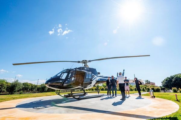
Découvre l'Etna en hélicoptère, à seulement 30 minutes de Fiumefreddo : admire huit points de repère depuis les airs
5.0 (87) 5.0 étoiles sur 5, 87 avisÀ environ trente minutes au-dessus des cratères du sommet, de la vallée del Bove et de Piano Provenzana, au départ de l'héliport privé de Fiumefreddo. Poids maximum par passager : 105 kg.
€ 350.00 -
 Annulation gratuite
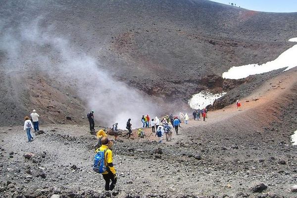
Etna Nord avec Coach : Trois heures gratuites à 1 900 mètres, au-dessus de Pizzi Deneri
4.7 (76) 4.7 étoiles sur 5, 76 avisTrois heures libres à Piano Provenzana, avec un véhicule 4x4 pour te rendre à Pizzi Deneri et admirer le point de vue à 2 900 mètres d'altitude, une décision que tu prendras sur place. Cinq arrêts possibles sur la côte.
€ 48.00 -
 Annulation gratuite
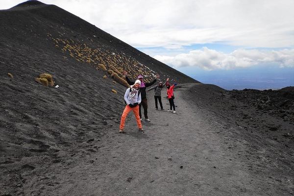
Excursion d'une demi-journée au volcan Etna au départ de Catane : groupes de huit personnes, jusqu'à Sapienza, à 1 986 mètres d'altitude
4.8 (595) 4.8 étoiles sur 5, 595 avisLe nombre de participants est limité à huit personnes. Tu pourras accéder au refuge Sapienza, situé à 1 986 mètres d'altitude, et explorer une grotte de lave, avec un casque et une lampe frontale. Tu pourras également déguster du miel et de l'huile d'olive.
€ 59.00
Notes recueillies par Viator et Tripadvisor